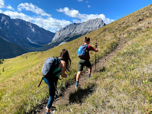
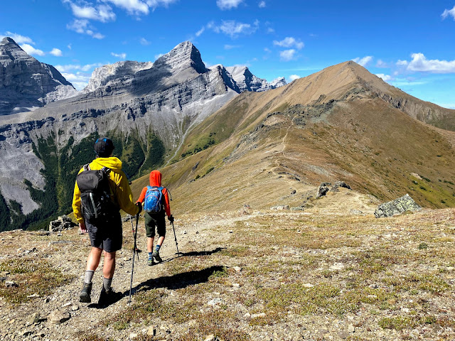
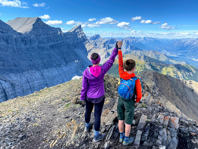
Centennial Ridge is the highest maintained trail ever built in the Canadian Rockies and is one of the best ridge walks in all of Kananaskis. Strong hikers can continue to the summit of Mount Allan which looms high above the Nakiska Ski Area. This is a very long day hike but it should go on every local hiker's "someday" list. Families will appreciate that there are few technical challenges and it's largely just a long scenic hike on a well built trail.
 |
| Hiking Centennial Ridge, the highest maintained trail in the Canadian Rockies |
 |
| Hiking through the Rock Garden is a highlight on Centennial Ridge |
Stats for the Hike
Distance: 16 km round trip from Ribbon Creek to the summit of Mt. Allan according to my guide book. (I tracked 17 km.)
It's also possible to do a one-way traverse from Ribbon Creek to Dead Man's Flats but then you'd need two vehicles, you have an extra 2.5 km of hiking, and you also have an extra 200 metres of height loss at the end because Dead Man's Flats is lower than Ribbon Creek (so whatever you do, don't start at Dead Man's Flats!)
All in all, it's just much easier to do the trip as an out and back hike starting and ending at Ribbon Creek.
Height gain: 1300 metres height gain from Ribbon Creek to the Mt. Allan summit. (I tracked 1400 metres including all ups and downs.)
Time it took us to complete the return hike: It took us just under 9 hours for this one (like I said, long day!) This was a solid moderate pace and we were faster than several adult groups on the trail so plan for 8+ hours depending on your personal pace.
Best time to do this hike: Wait until late June when the snow will be clear on the route. This is a beautiful summer hike when everything is very green and there are lots of marmots playing around in the rocks along the ridge.
Fall is another good time for this hike because there are larch trees along the ridge. The peak for golden larch hiking is the third weekend in September.
Annual Seasonal Closure: April 1 - June 21 for the protection of bighorn sheep during a sensitive birthing period
And don't forget to purchase your Kananaskis Conservation Pass!
 |
| Mount Allan Summit looking over the Wind Valley |
Rating: This is an easy scramble or an advanced hike. You won't have to use your hands at all on the trail to Olympic Summit. There is one small cliff band after that which requires some hands-on scrambling to reach the summit of Mt. Allan.
There's a fairly decent trail the whole time and much of the trip is just steep hiking. Route finding is also generally easy once you get off the ski trails from Ribbon Creek.
And best of all, there is no bad scree on this hike nor is there any real exposure (other than the one small cliff band mentioned above.)
Recommended Guide Book: Kananaskis Country Trail Guide, Volume 1, Gillean Daffern - Amazon affiliate link
All Trails Link: Mount Allan from Centennial Ridge
Note to download the map, you'll need to have a premium paid subscription. I find it to be worthwhile, even just so I can see how far I am from the summit every time somebody asks "how much further?"
Having a downloaded map will also help you navigate through the ski trails down below.
Map of our Route:
And should you want to navigate using my routes, you can follow me on All Trails.
You can also follow me on Strava.
 |
| Looking down over the Nakiska Ski Area from Centennial Ridge |
Ribbon Creek to the Centennial Ridge Trail
You'll park at the Ribbon Creek trailhead (google maps link) and start by hiking up the Hidden Trail, a wide cross-country ski trail. Within 300 metres there is a junction with the Coal Mine Trail where you turn left on another ski trail. Stay on this trail until you come to the official "Centennial Ridge Trail" sign and the trail becomes more narrow resembling an actual hiking trail.
That was your warm up. Now the climbing begins. The Coal Mine ski trail takes a more gradual approach but the Centennial Ridge trail climbs straight up between switchbacks on the Coal Mine Trail.
The first section of the hike is approximately 2.5 km in length and you'll climb a very gradual 250 metres of height until you cross the Coal Mine Ski Trail for the final time.
After this, it is straight UP until you reach the Olympic Summit.
 |
| The end of the ski trails at the Coal Mine site |
Climbing to the top of the Olympic Summit (and the beginning of the ridge walk)
From the end of the Coal Mine Trail where you leave all ski trails long behind, it is a steep climb to your first summit (and you won't be alone if you decide that Olympic Summit is as far as you can make it.)
The trail to Olympic Summit is well maintained and easy to follow, but it is steep! There are many switchbacks (thank goodness) but you will be tired when you reach the top of the first summit.
 |
| The trail to Olympic Summit is relentlessly steep but well switchbacked |
It is a 700 metre climb to the top of Olympic Summit overlooking the Nakiska Ski Area (plus the 250 metres you already climbed to get to the end of the ski trails.) This means you'll have already climbed 950 metres just to get to the top of Olympic Summit! And you still have 350 metres to go! - Like I said, it's a BIG day.
 |
| It's a gorgeous hike to Olympic Summit (even if you call it a day here!) |
Distance to the top of the Olympic Summit is 3 km (So you'll climb 700 metres in 3 km.) And then add on the initial 2.5 km for 5.5 km of total distance just to reach the first summit of the day. - Good news, you only have 2.5 to 3 km left of hiking along Centennial Ridge to reach Mt. Allan.
 |
| Just a tad steep! |
Ribbon Creek to the end of the ski trails and Coal Mine site: 2.5 km (250 metres climbing)
Coal Mine to Olympic Summit: 3 km (700 metres climbing)
Olympic Summit to Mt. Allan along Centennial Ridge: 2.5 to 3 km (350 metres climbing)
All numbers are approximate! Every guide book/website varies slightly from the All Trails app, and then my own personal stats were different yet.
 |
| If you do nothing but Olympic Summit, it's still a rock star hike! |
You'll know you've arrived when you reach a weather station and then a small cairn with a flag. This is your first summit and the Nakiska ski area is far below you now.
 |
| Reaching Olympic Summit above the Nakiska ski area |
 |
| If only Nakiska ran chairlifts in the summer! |
Hiking across Centennial Ridge to the Rock Garden
 |
| Easy hiking along Centennial Ridge, the rock garden and the final summit of Mt. Allan ahead |
 |
| The giant "Claw!" |
 |
| The short cliff band that you have to down climb to reach the summit |
Hiking to the Summit of Mt. Allan
 |
| There's a good trail to the summit |
 |
| Mt. Allan Summit |
 |
| On the Mt. Allan Summit looking down over the Wind Valley |
The Return Hike to Ribbon Creek
 |
| Climbing back up the cliff band to the rock garden |
 |
| Hiking back through the rock garden |


No comments:
Post a Comment