There are very few hiking trails that I would repeat annually, but Powderface Ridge is one of them. We keep finding new and creative ways to hike this trail, and it never really gets old as a destination. It's the perfect first summit for families, and there are several options to make the trip as short or as long as you want it to be.
 |
| Powderface Ridge sunset hike in June (photo: Joyce Cortes) |
The Official Trailhead and Route up Powderface Ridge
This official trailhead for this ridge starts at the end of highway 66 in the Elbow Valley where the pavement ends (right before you drive into the Little Elbow Campground.) From this parking area it's a steep 600 metre climb (13 km round trip distance.)
You can read about the official trail and see a map on the Kananaskis Trails website. And if you have a copy of the Kananaskis Country Trail Guide, Volume 2, by Gillean Daffern you can read all about the trail there (Trip 31.)
And note, the highway only opens on May 15th each spring so while this is a great spring hike, wait until the road is open past Elbow Falls.
 |
| This large boulder begs to be climbed while hiking up or down the Powderface Ridge trail |
My personal opinion about the official trail for Powderface Ridge can be summed up in one word: DOWN. This is a great way down from the ridge. It sucks as a climbing route. I like doing a one-way shuttle for this hike, starting high and ending low.
I have hiked Powderface Ridge many many times, but I've never climbed up the official trail because I don't seen a point in starting at the lowest point possible to access the ridge, especially when there are two other routes that both start much higher!
 |
| Powderface Ridge is a beautiful ridge in the Elbow Valley |
Powderface Ridge via Three Trail Pass
For an easier outing, we always do a traverse (with a car shuttle) via Three Trail Pass allowing us to gain only 400 metres of height, hiking across the ridge, and descending the official trail in a complete distance of approximately 8 km.
To access this shortcut trail and by far the easiest access for the ridge, turn right on to the gravel Powderface Trail (road) when you get to the Little Elbow Campground and the end of the paved Highway 66.
 |
| You'll enjoy a long meadow traverse to the summit of Powderface Ridge from Three Trail Pass |
Drive up the Powderface Trail road for approximately 6 km until you reach Sacramento Pass. You can see the Google maps location for the Three Trail Pass trailhead here.
You can also see the complete traverse on All Trails here.
Note the All Trails link above has you starting at Highway 66 but this is where you want to END. You want to start high, finish low. You should be starting from the Powderface Trail road and then ending on Highway 66 at the entrance to the campground.
Because the All Trails version of this hike is done in reverse, the numbers for height gain will be off. The distance is also a bit high.
Follow this link to a good description from the Alberta Parks website (where there is a good map showing both trailheads.)
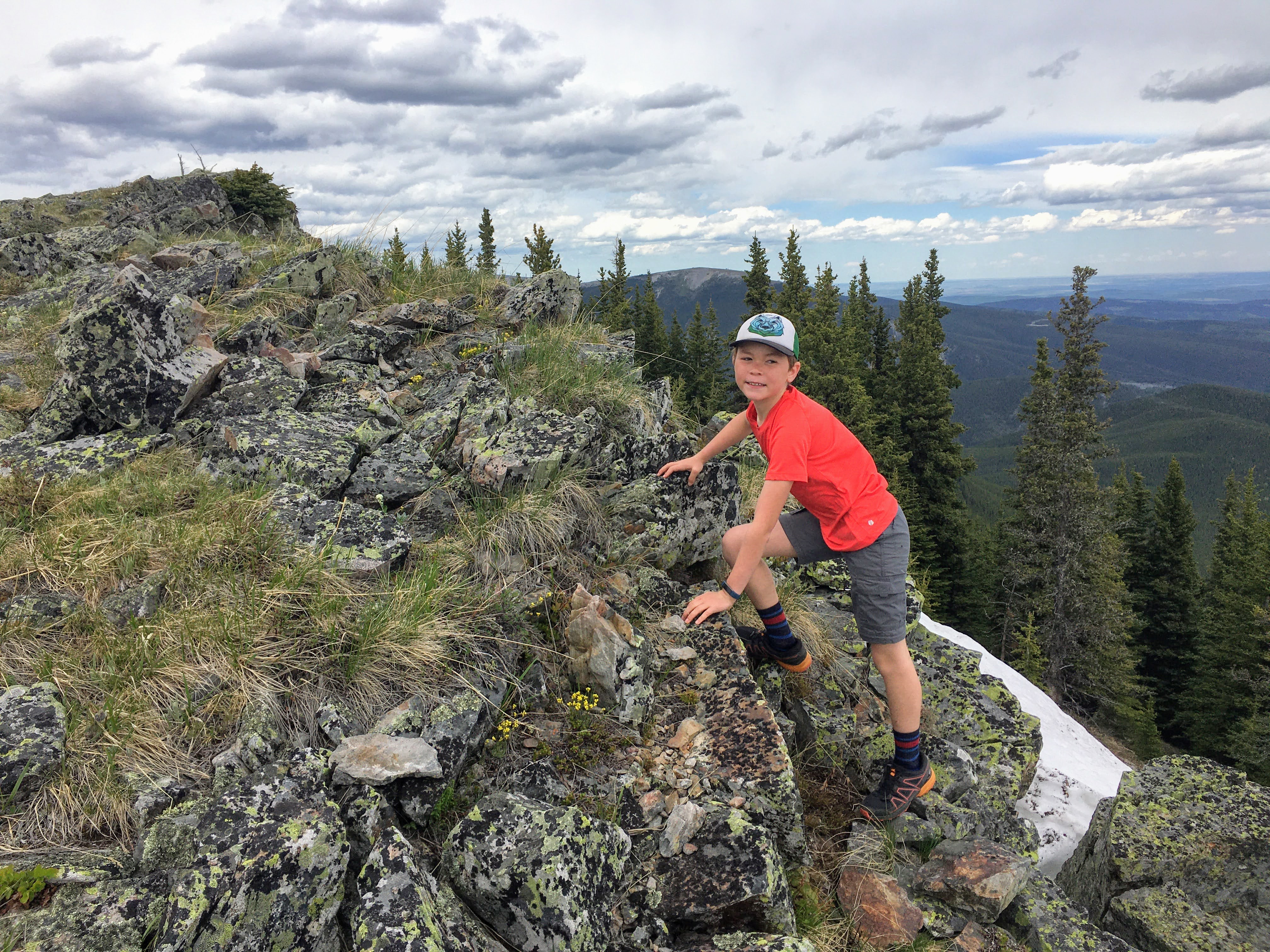 |
| There are lots of fun scrambly rocks at the summit of Powderface Ridge |
Route Description for the Powderface Ridge Traverse
From Powderface Trail, you'll begin by hiking a kilometre on an old road /double track trail to a three-way junction, climbing a gradual 150 metres of height. This is Three Trail Pass and here you'll turn right to climb up to the ridge. Don't go straight or you'll find yourself heading along the Powderface Creek trail which ends by Elbow Falls! It's a great mountain biking trail but not too fun as a hike.
 |
| The trail climbs a rocky wide road to Three Trail Pass |
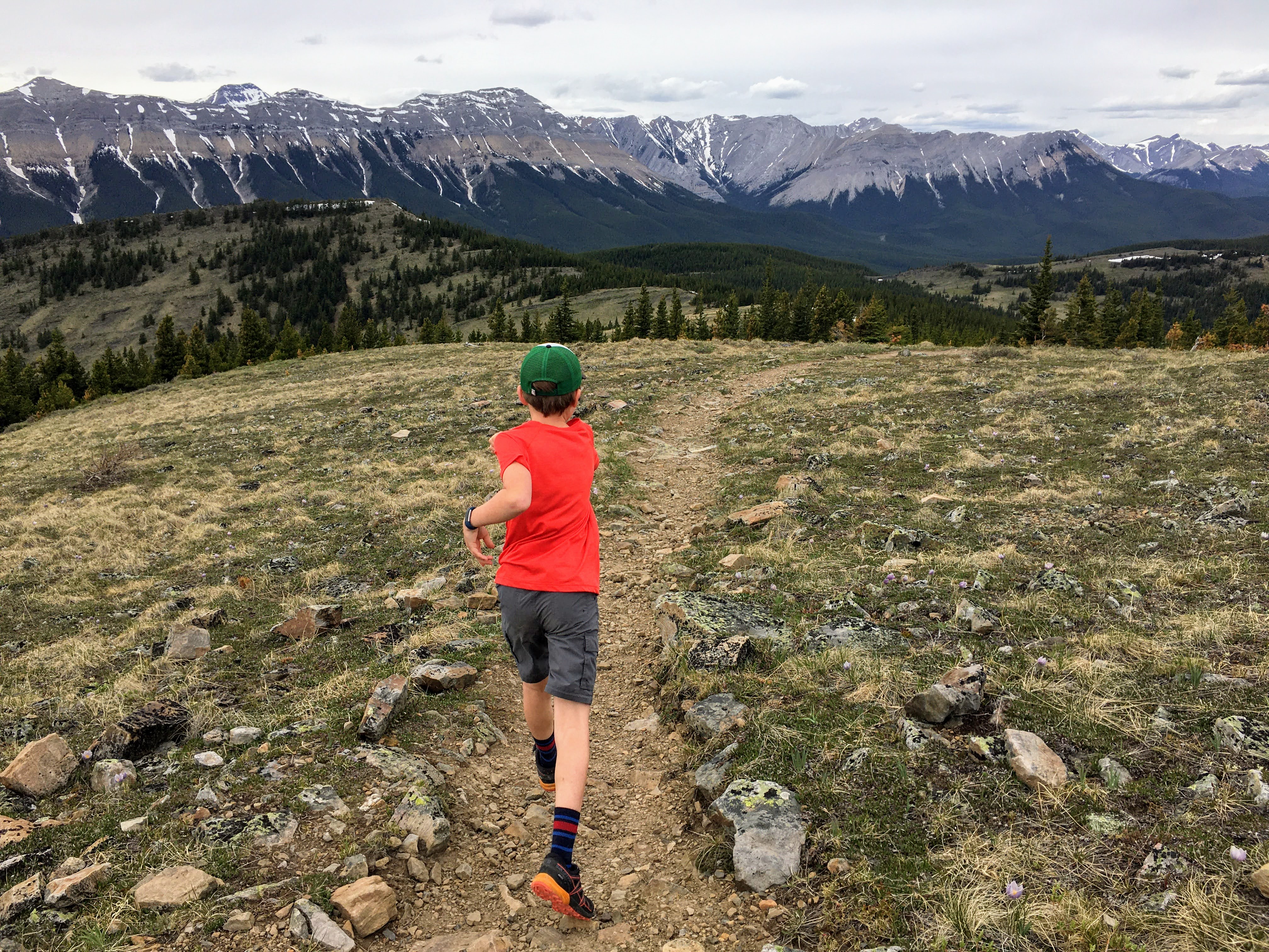
From Three Trail Pass the hike starts to get more beautiful as you climb up and through grassy meadows to gain the ridge and official summit for Powderface Ridge. This section is approximately 2 km in length and you'll gain another ~ 150 metres of height. The hiking is never steep and the ridge is not narrow.
 |
| Three Trail Pass with the ridge visible above |
Either turn around once you reach the summit or (if you've set up a vehicle at the far end) continue hiking towards the exit trailhead on Highway 66.
 |
| Powderface Ridge is a beautiful hike in the Elbow Valley |
And this is where I mention that all distances and height gain references in this guide are approximate numbers! I've used several different guide books, websites, and apps to create this guide, and every single one is slightly different!
 |
| Early season snow on the ridge crest |
From the ridge, drop down off the opposite side of the ridge, following the trail that descends from the summit. You don't have to traverse the ridge very far before you'll see the trail leaving the ridge.
If you hike this trail early season there may still be snow on this section requiring you to kick steps as you descend off the ridge (or follow steps others have made.) Once below the ridge crest, the snow disappears.
 |
| Descending the ridge on early season snow |
The trail loses 100 metres of height over the next couple of kilometres as you descend through trees without views. At the bottom, you'll arrive in another large meadow and you have the option of climbing up to the East Summit. It's a quick "run up and down" with less than 50 metres of climbing to reach this summit, and in my opinion it is highly worth it for great views over the Elbow Valley. This summit also feels more like an official summit than the one on the ridge top.
Tag the East summit if you want, or continue your hike through the meadow and down the official Powderface Ridge trail to the trailhead on Highway 66. This is where you'll lose another 400 metres of height over 3.5 km.
The trail down from the meadow travels through trees much of the time without views. It is never overly steep, and the trail is good, but those with bad knees will definitely know they are descending!
 |
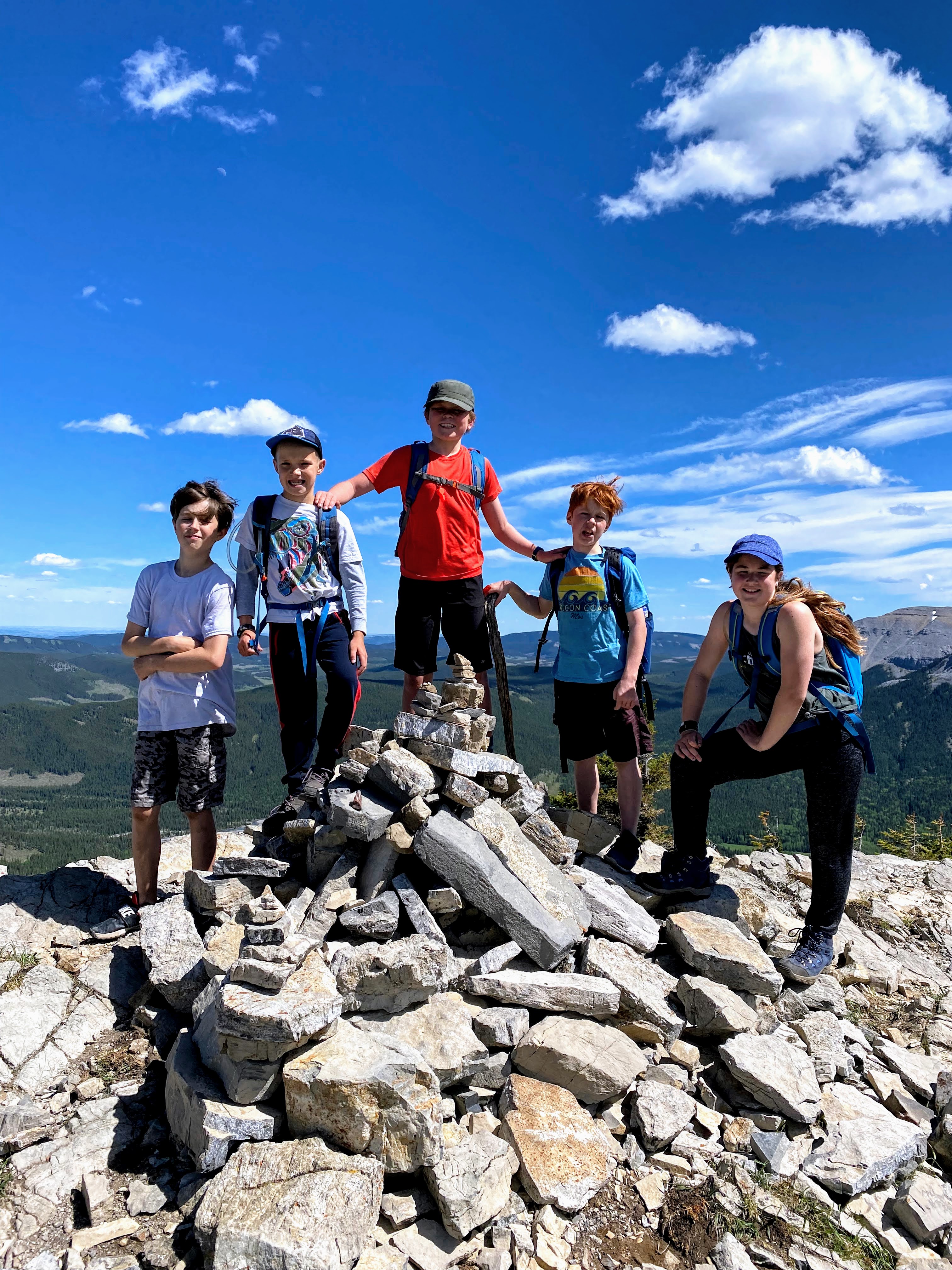
| East summit of Powderface Ridge |
Easy Peasy Shortest Hike Possible for Powderface Ridge
Start and end your hike via Three Trail Pass for the easiest hike (6 km round trip.)
This is a great one with young kids or as a half day hike.
 |
| It's only 6 km round trip to tag the official summit via Three Trail Pass |
Powderface East Ridge Trail from Rainy Creek Summit
For an alternate (shorter route) to the East Summit, you can start from Rainy Creek Summit and take the East Ridge Trail off Highway 66 for a short 4 km round trip outing with 400 metres of height gain.
The East summit feels most like a real "summit" and it's a great evening hike. Note the East Ridge Trail is steeper than the route via Three Trail Pass. You'll also be hiking along a rocky ridge for a bit where the terrain could feel a bit scrambly for some.
 |
| Hiking up the Powderface East Ridge Trail |
Tagging both summits from the East Ridge Trail would amount to ~ 150 metres of extra climbing and 4 extra kilometres of hiking.
See the Google Maps location for Rainy Creek Summit where you'll park here.
 |
| Youth hike up the Powderface East Ridge Trail to the East Summit |
Alternate Traverse: Three Trail Pass to Rainy Creek Summit
This route is only 9.5 km long with an easy 450 metres of climbing! (SCORE!)
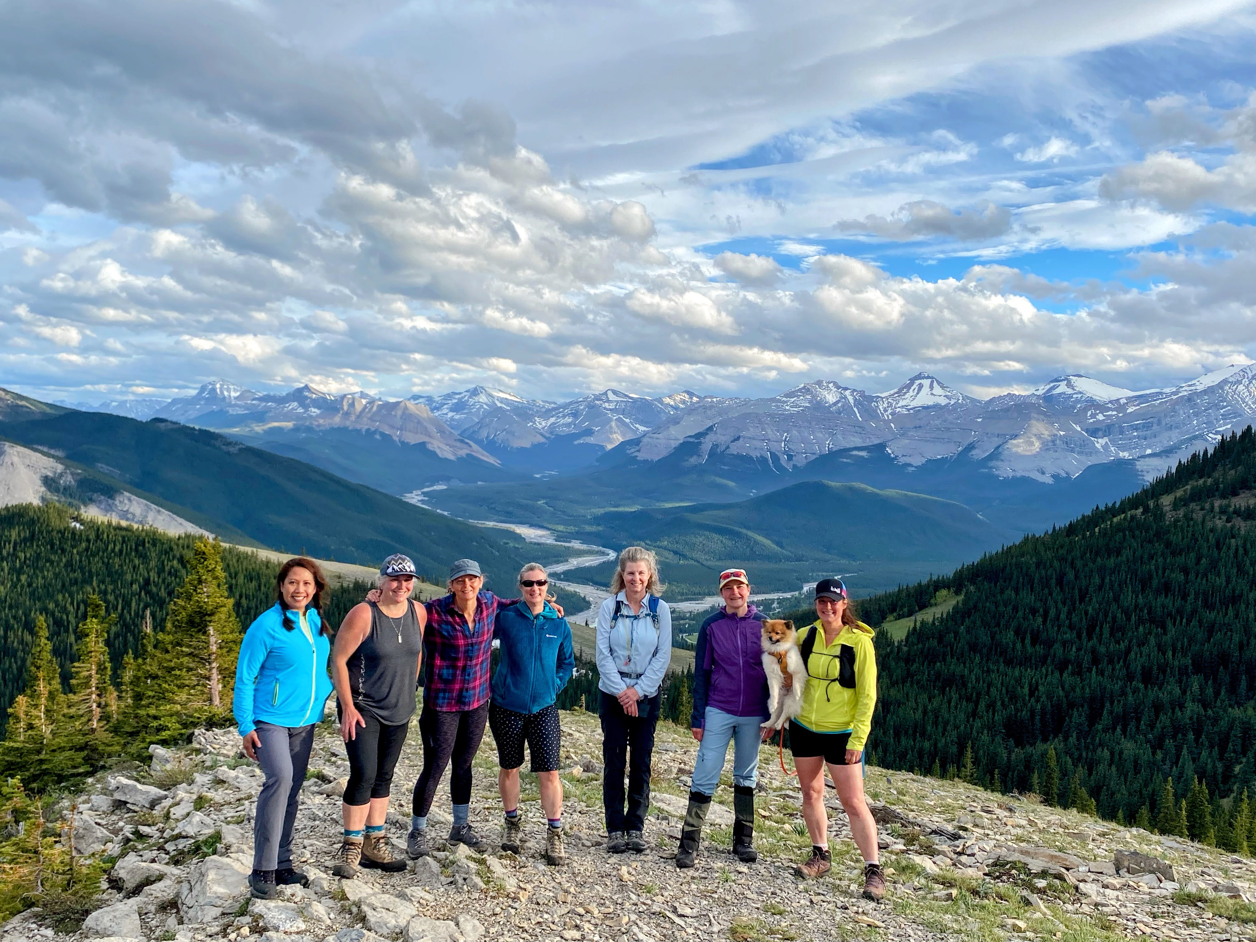 |
| Girls night out on the East Powderface Summit |
Read more about Hiking in the Elbow Valley
