Wednesday, May 11, 2022

First Summits - Wasootch Peak, Kananaskis

Wasootch Peak is the unofficial name for a small mountain located near Kananaskis Village, and it is not connected to the popular Wasootch Ridge Trail. Wasootch Peak and Wasootch Ridge are different hikes starting from different trailheads.

Wasootch Peak is a fabulous early season training hike in spring and you'll get some serious height training completed on this very steep trail that finishes with a scrambly ending near the summit. Start with Prairie Mountain and a few other more "gradual" hikes before working your way up to Wasootch Peak. 

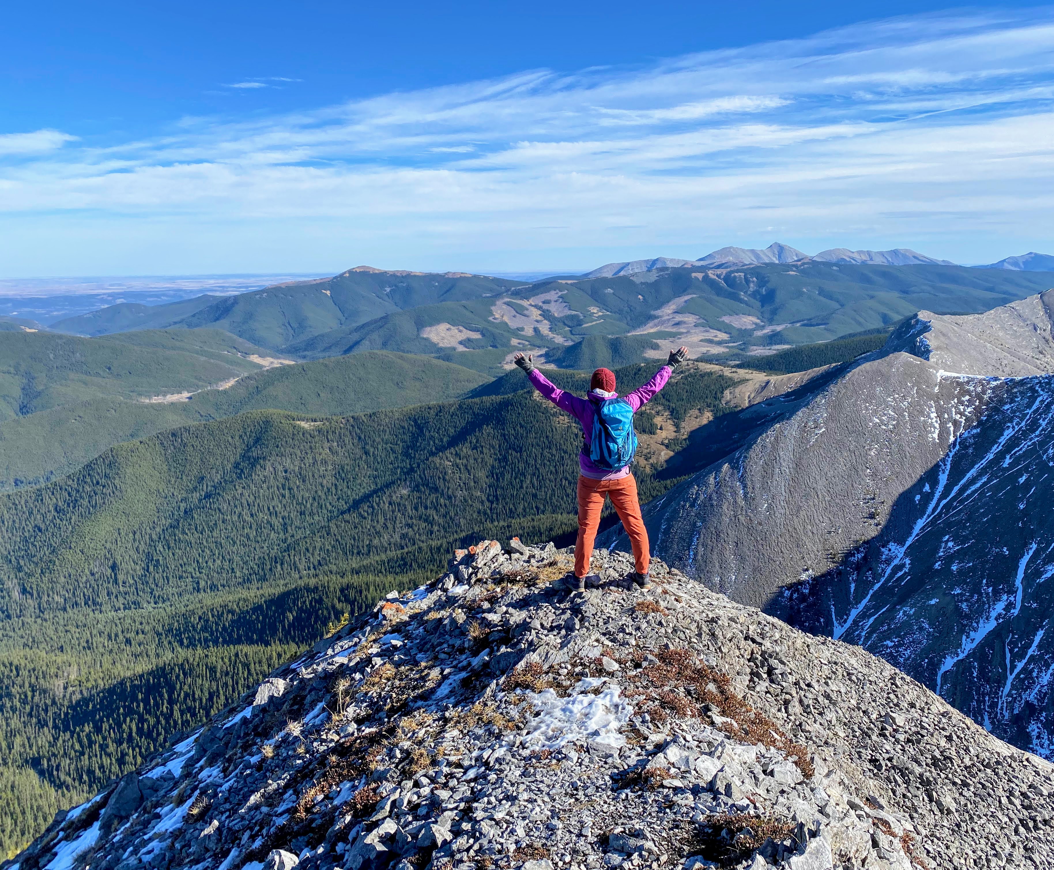
Wasootch Peak overlooking the Nakiska ski hill 


Stats for the Hike 

Distance:  7.5 km return


Height gain
: 900 metres 


Time it took us to complete the return hike: 
It took us 5.5 hours (3 hours moving - man we take a lot of breaks) with two youth ages 10 and 12.


Best time to do this hike: Wait until late April / Early May to make sure the snow has melted from the trail. Even then it's suggested you bring ice cleats or spikes for any lingering snow.


Rating
: This is an easy scramble. It's more than a hike, but you shouldn't have to use your hands much (or at all.) There's a fairly decent trail the whole time and much of it is just a steep forested path. The only loose gross scree is at the top in the final 100 metres where this hike gets its "scramble" rating. If you don't like scree you won't make it to the summit.


All Trails Link 
Wasootch Peak on All Trails 

Note to download the map, you'll need to have a premium paid subscription. I find it to be worthwhile, even just so I can see how far I am from the summit every time somebody asks "how much further?" 

I also like to download the map so that I know where to park. There is no official parking lot for this one, so at least look at the map on your home computer and then put a pin on Google Maps so you know where to pull off the highway.

The hike gets scramblier the higher you go

Everybody's favourite rock on the Wasootch Peak hike

Finding the Trailhead

Drive out towards Kananaskis Village on Highway 40 and do a U-turn right after you exit the highway for the Village - when it's safe to do so!!

You're going to be turning around here and parking immediately along the side of the road where there will probably be other cars parked. There is space to park so that you're not right on the highway but exercise caution getting your gear out of the car.

You can find the spot to park on Google Maps. 

Looking up at the summit of Wasootch Peak from the creek at the bottom


Segment 1: Hiking up through the forest

Head up from the highway into the trees watching for the empty creek bed that you see in the photo above. The hiking trail is to the left of the creek bed and once you get on it, you can't lose it. It's a very good trail.

The trail is easy to follow, but is relentlessly steep!! I pretty much swore I'd only ever do this hike once (even though I'm now contemplating doing it again for training.)

My best advice: bring candy and fun snacks, take your time, and push on for the more interesting terrain above. Once you get to the easy scrambly terrain, the hiking becomes much more fun on this trail!

The first 2 km will be the worst part for hiking up a "boring trail through the trees."

Hiking up a steep trail through the forest and above to reach the summit of Wasootch Peak

Segment 2: Fun scrambling up mini cliff bands and rock

Finally after the first couple of kilometres the hike starts to get interesting! There are mini cliff bands, there's a bit of easy route finding, and you aren't just plodding up steep dirt.

We were with friends who are still fairly new to scrambling and they had no problems on this section. They were slower coming down, but just take your time.

Easy scrambling up baby cliff bands on the Wasootch Peak Trail

There are lots of good viewpoints where you can stop and catch your breath 

Minimal hands-required scrambling on the Wasootch Peak Trail


Segment 3: All the nasty scree to the summit!

I can handle plodding up a boring trail through the trees and I'm ok with easy fun scrambly terrain, but I draw a line at nasty scree so I did not enjoy the final 100 metres of height gain.

That being said, put your head down, trust your feet, take your time, and try to choose the best line.

I found the trail to be best along the far right side, next to the skyline (even though it dropped off steeply here.) We also tried to stick to the slabs as much as we could because they were beautifully grippy!! 

Our friends called it quits here and waited for us to summit. 

This is what awaits you at the end of the hike!

Our friends made it about half way up the final scree slope

The slabs were gloriously grippy for going up


Reaching the Summit of Wasootch Peak

We finally reached the top of the ridge and then enjoyed a bit of easy scrambling to reach the summit. There was also a very short section of airy ridge traversing before the summit. I'd say that if you don't like heights, you won't enjoy the final section.

Looking down at Highway 40 towards the Nakiska ski hill 

The final ridge walk to the summit is a tad airy

Next time I plan to hang out here a little longer to take in the views

Caution is definitely needed at the summit

Making our way down "Carefully!!" 

Return the same way you came, slowly, and carefully. The rock definitely felt loose coming down the steep scree at the top. Once we got lower down it was easy walking though.

Looking back up at the scrambly terrain below the summit

Slowly and carefully descending the Wasootch Peak Trail 


Recommended Gear and Safety Tips 

  • This is not a beginner hike and children should have previous scrambling experience on steep terrain and loose rock. My son is very experienced and found the hike easy. His friend did not.

  • The final summit ridge is narrow and extreme caution needs to be taken with children here. If you're nervous at all, skip the final walk to the summit and stop once you reach the ridge.

  • Check the weather report carefully before you go and watch the skies while hiking. I wouldn't want to be caught near the summit on this mountain in a storm.

  • Bring light gloves for the descent. They'll protect your hands if you fall and you may appreciate them if you need to use your hands at all on the cliff bands.

  • We didn't feel that helmets were necessary for this hike, but they would be appreciated if somebody took a tumble! We had also chosen a very quiet day mid-week and didn't see anybody else on the trail. Rock fall could be a hazard if you went on a weekend.

  • Long pants are always a good call when scrambling. A thin lightweight long sleeve shirt is recommended too on descent. If you slip on loose rock, you'll be happier if you have a layer of clothing between your skin and the rock.

  • If you're not sure your children are ready for this hike, try it solo without them first. We do a lot of hikes on our own before bringing our son. This was one of the few where my son and I both did the hike for the first time together.

  • Finally, this hike would not be the best choice for a hot summer day. There is no shade on the upper slopes and you're far from any water source.

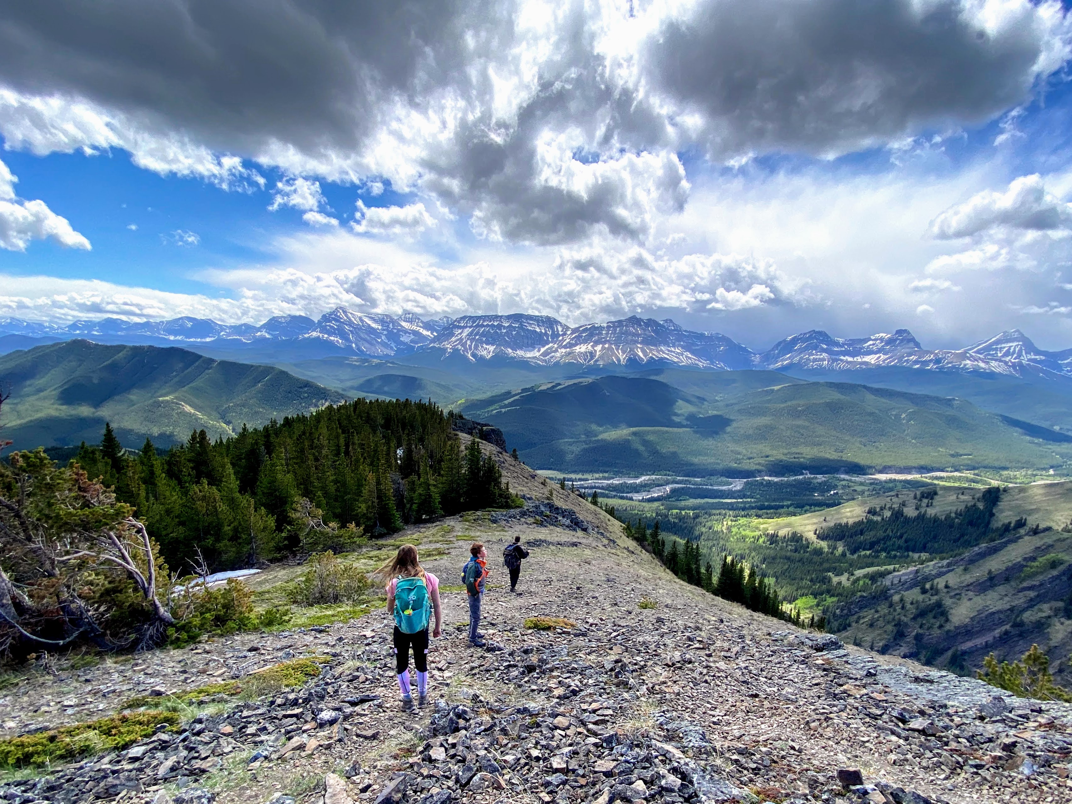
Wasootch Peak is a great scramble for families with previous experience


Wednesday, May 04, 2022

Spring Hiking Super Guide to the Best Trails in Kananaskis

From toddler rambles to full day scrambles, this guide will have you covered as you build your spring hiking list for another year and seek to try a few new trails or find a new favourite destination near Calgary. 

This guide will be updated annually with new favs. so keep it handy and check back each spring for more suggestions. 

Spring Hiking Super Guide to the Best Trails in Kananaskis (Photo: Midnight Peak)

Spring hiking in Kananaskis is glorious! (Photo: Junction Hill)


Areas I've focused on in this guide


I've focused on areas of Kananaskis that are good for hiking from April through early June. Therefore I have only included Highway 40 hikes that are near or north of Kananaskis Village and I haven't included any hikes in the Highwood Pass area since the road is closed until June 15th. 

I have also chosen to leave out all hikes along the Smith Dorrien/Spray Lakes Road because that area holds its snow well into June.

This guide focuses on early season hiking objectives that will hopefully dry out sooner than other trails through the Rockies.

Lesueur Ridge is a fantastic spring hike near Calgary 


Before you Hike! 


Before you hit the trail please take a few moments to think about how you will keep yourself and your family safe this spring.

  • Always carry bear spray with you and know how to use it. I also like hiking in a group for safety.

  • Protect your family from ticks which are very active in spring. There is a lot of reading on the subject out there, but in a nut shell, ticks crawl upwards from the ground! This means if you find one attached to your scalp, it crawled all the way up there from your boots, from that backpack you left on the ground at lunch, or it was given a free ride when you sat on the ground for a break. I try to stand while eating and try not to set any of my belongings on the ground.

    I also believe in spraying our boots, our pant legs, our gaiters, and even our necks/behind our ears, with a good tick repellant. My favourite is either Kombat (from Home Depot) or PiActive (which you can pick up from MEC or Canadian Tire.) Both use an ingredient called Icaridin which I find works better against ticks than traditional Deet.

    And don't forget to check yourselves when you get home! Most hikers like to throw their clothing straight in the wash machine as well (or to run them through the drier on high to kill any ticks you've brought home.) 

  • Check Alberta Parks Trail reports for closures or wildlife warnings. The All Trails app is a great resource but it can't always be trusted for current closures and official updates. 

  • Be prepared with spikes or ice cleats if hiking early season. Most trails will still have icy sections well through May. I leave them in my vehicle and they come on every hike until July!

  • Avoid hiking muddy trails (which can cause permanent damage to the trail.) I like to check the All Trails website or app before I head out for recent trail reports. There are several good hiking groups on Facebook as well where you can get updates on popular trails.

Junction Hill is a great spring hike in South Kananaskis

Finding the Hikes in this Guide 


Every hike in this guide has a link to the All Trails website (which isn't perfect, but is certainly useful and will definitely help you find the trailhead.)

I also recommend the following guide books:

Finally, I have included links for previous blog posts I've written on the hikes below. (I'm a bit behind on a few but they're coming.) 

Vents Ridge is a great spring hike in the Elbow Valley near Calgary


Spring Hiking in the Elbow Valley


These hikes are all located off Highway 66 past Bragg Creek to the SW of Calgary. It's a favourite area for us to explore from Calgary because of the short drive. The trails also come into condition sooner in the spring, being closer to the front ranges.

The Best Easy Hikes in the Elbow Valley

  1. Paddy's Flat Interpretive Trail - Park at the gate to the Paddy's Flat Campground if it is not open and hike down towards the river to find the trail. Hike as far as you like and return the same way. We've also used balance bikes on this trail and there are fun beach areas to play at beside the river.

  2. Beaver Flats Interpretive Trail - Before May 15th, park by the winter gate above Elbow Falls and hike along the closed highway to reach the trailhead at the Beaver Lodge Day Use Area (5 minutes on foot down the road.) After May 15th you can park at the trailhead or access the trail from the Beaver Flats Campground at the other end of the trail. 

    The trail is only 1.5 km one way and there is a fun pond to play at along the way. We've also used balance bikes on this trail. Before the road opens on May 15th, you can also bike the closed highway to the Beaver Flats Campground. (Read more below in my story on biking closed campgrounds.)

  3. Fullerton Loop - Park at the Allen Bill Day Use Area for this one. The loop is 7 km in distance with 200 metres of height gain.


The Beaver Flats Interpretive Trail is fun with young children


Our Favourite Spring Hikes in the Elbow Valley:

  1. White Buddha and Vents Ridge (4 km return, 300 metres height)

  2. Powderface Creek and Prairie Creek Loop Via Vents Ridge (5.5 km loop, 350 metres height gain)

  3. Prairie Mountain (7 km return, 700 metres height gain)

  4. Powderface Ridge via Three Trail Pass - accessible after May 15th. This is the shortest way to reach the top of the ridge with ~ 300 metres of height gain over ~ 3.5 km one way.

    We like to do a one-way traverse with a car shuttle finishing low at the end of Highway 66. Height loss is then ~ 700 metres with a distance of 11.5 km one way.

  5. Powderface East Ridge from Rainy Creek Summit - accessible after May 15th. (4 km return, 400 metres height gain - can be done as a traverse using one of the Powderface Ridge Trails above with a car shuttle.)

    If you're going to do a traverse, the highest starting point is via Three Trail Pass. Rainy Creek Summit is also a good starting point. Never start at the end of Highway 66 which is the lowest point (and requires the most climbing to reach the ridge.)

    And for an epic traverse, try Three Trail Pass to Rainy Creek Summit. It's only 9.5 km one way with 450 metres of height gain, but you'll start and end at the highest access points. 

  6. Nihahi Ridge - accessible after May 15th (8 km return to the South Summit, 700 metres height gain.)

    You can also skip the scrambling by turning around at the end of the official hiking trail (5 km return, 400 metres height gain)


Early spring hiking on Prairie Mountain in the Elbow Valley 

Other Recommended Spring Hikes in the Elbow Valley:

  1. Ford Knoll Loop - accessible after May 15th (5 km loop, 200 metres height gain)

  2. Mustang Hills and Rainy Creek Falls - accessible after May 15th (3 km return, 200 metres height gain - can be made into a bigger loop as well)

  3. Canyon Creek ice cave (13 km return, 500 metres height gain - first 5 km can be biked on a closed gravel road)

  4. Trails around West Bragg Creek  - There are endless options here with many easy to moderate trails, many of them wide ski trails in winter.

Every kid's favourite boulder on Powderface Ridge in the Elbow Valley

Spring Hiking South of Bragg Creek 


If you drive south of Bragg Creek towards the Hamlet of Millarville, you'll come to the Mesa Butte Provincial Recreation Area.

Mesa Butte is a popular spring hike in South Kananaskis, and is the only trail I know that has a fire pit on the summit! The promise of roasted marshmallows or hot dogs should motivate most youth to tromp their way up the Grind, and there are several options for starting points to make this hike as short or as long as you want it to be.


Mesa Butte is a fabulous choice for an early spring hike!


Spring Hiking in the Ghost Public Land Use Zone


If you head west on the Highway 1A past Cochrane and then turn north on the forestry trunk road, Highway 40, you'll arrive in the tiny Village of Waiprous. Beyond that, you'll come to a wild area known as the Ghost where rules are few, random camping is extremely popular, and the roads are notoriously bad. Most trailheads are hard to get to and you'll have to drive across a river to reach many of them.

The two hikes below are located before the river crossing and are easier to get to than most in the Ghost. You can reach both trails in a normal vehicle as long as you take the gravel road slowly.

Make sure you download a map before heading out because most trailheads in the Ghost are not signed or marked. 

Both of these hikes below are excellent early season choices and can be hiked as early as late March.

Lesueur Ridge in the Ghost in March 

Our Favourite Spring Hikes in the Ghost:

  1. Lesueur Ridge  - This trail offers great scenery and hiking for such an easy outing early season (8 km loop, 400 metres height gain) 

  2. Mockingbird Lookout - This hike takes you to an active fire lookout site (6 km return, 350 metres height gain)


Mockingbird Lookout in the Ghost 


Spring Hiking in the Jumpingpound and Sibbald Creek Areas


Head West on the TransCanada Hwy and then turn south on Sibbald Creek Trail (Highway 68.) This gravel road takes you to great early season hikes in the Sibbald Creek Region and provides access to the Powderface Trail road where you'll find other popular hikes which can be accessed after May 15th.

The first two trips are accessed from the Sibbald Lake Campground and can actually be connected in the same hike if you want.

Cox Hill summit in the green season (Wait till June if you love rolling green hills)

Our Favourite Spring Hikes in the Jumpingpound/Sibbald Creek Areas:

  1. Eagle Hill - 14 km return, 500 metres height gain.

    Can also be accessed from the Seventy Buck Trailhead for a shorter distance of 8 km return and only 300 metres height gain. We like to do the hike as a one way traverse from Seventy Buck to Sibbald Lake with a car shuttle.

  2. Deer Ridge - 6 km loop, 300 metres height gain 

  3. Cox Hill - accessed from the Dawson Day Use Area on Powderface Trail before the winter road closure (13 km return, 800 metres height gain)

  4. Jumpingpound Summit Trail - accessible after May 15th from Powderface Trail (6 km return, 400 metres height gain)

    And I highly recommend the glorious one-way traverse of Jumpingpound Ridge and Cox Hill with a car shuttle. It's a quick climb to the Jumpingpound Summit, after which you enjoy a beautiful ridge walk to the summit of Cox Hill before descending to the Dawson Day Use Area. 

    As a traverse, the trip is ~ 15 km in distance with 700 metres of height gain, but 1000 metres of height loss (so make sure you start at the Jumpingpound Summit trailhead.)


Jumpingpound Ridge Summit 

Pink summit register on Eagle Hill 


Spring Hiking in the Kananaskis Valley (Highway 40)


When people think of "Kananaskis" they typically think of the area around Barrier Lake and Kananaskis Village along Highway 40. Fortunately there are some good spring hikes along this road if you don't drive too far south.

The Best Easy Hikes in the Kananaskis Valley: 

  1. Troll Falls to the Upper Falls - 3 km, 150 metres height gain to Troll Falls. (From there it is another 2 km return with 70 metres height gain to reach the Upper Falls on an official signed trail.) 

    On this hike you'll visit Troll Falls, Marmot Falls (where you can hike behind the waterfall,) and finally the two tier Upper Falls above, all from an excellent trail.

  2. Widow Maker Trail - This is a beautiful trail that follows the Kananaskis River where you can watch river surfers and kayakers playing in the waves. (4 km return, 100 metres height gain.)

    While much of the trail stays safely above the river, you can also go down beside the river where you'll want to keep a close eye on young children and keep them within arms reach. And if you read the story I below, I make no promises that the picnic table is still there beside the river.

Read: The New Hiking Trail to Troll Falls and the Upper Falls, Kananaskis 

Read: The Best Picnic Spot in Kananaskis (The Widow Maker Trail)

The Widow Maker Trail is an easy flat hike for young children

Marmot Falls where you can walk behind the waterfall


Our Favourite Spring Hikes in the Kananaskis Valley:

  1. Prairie View and Barrier Fire Lookout / Yates Mountain - This hike visits an active fire lookout site. (12 km return, 700 metres height gain to reach the summit and fire lookout.)

    The hike can also be shortened by stopping at one of two viewpoints at the top of the Prairie View Trail. This also saves 125 metres of height gain.

  2. Wasootch Ridge - This steep trail provides quick views in short time. The hike is 13 km return or as far as you want because you can turn around anytime when you tire of climbing up and over each bump along the ridge. Total height gain is 900 metres if you go all the way to the final summit, which most people don't.

  3. Mt. Kidd Lookout - This trail visits a historic fire lookout site. The building is removed but it's still a beautiful viewpoint. (8 km return, 760 metres height gain) And you'll want to save this for later in spring because it's gorgeous when the hillside is green. So aim for early June.


The Mount Kidd Lookout is a gorgeous late spring hike


Spring Training Scrambles in the Kananaskis Valley:

  1. Wasootch Peak - This hike is crazy steep and you'll need to be comfortable on loose rock and scree to make the summit. It's a great early season training choice though before moving on to bigger mountains in the summer. (6 km return, 870 metres height gain)

  2. Baldy Pass to Midnight Peak - The trail to Baldy Pass is easily followed and well maintained. Beyond that, expect steep scrambling, lots of rock, and route finding to reach the summit of Midnight Peak. (12 km return, 1000 metres height gain)

  3. Baldy Pass to Mount Baldy South Peak - The trail to Baldy Pass isn't very exciting, but you can spice it up and improve views by continuing to the south peak of Mount Baldy in a lovely long ridge walk. (13 km return, 900 metres height gain) 

    When we did this one, we continued past South Baldy to gain the main peak of Mount Baldy. I do not recommend this with kids (see my story below) unless you have significant rock climbing and scrambling experience as a family. We used a rope.

  4. Mount Baldy Main Summit - You approach the main summit of Mount Baldy from a different trailhead and it is a very steep hike with loose rock/scree and some solid moments requiring hands on scrambling. Don't try this one with kids unless you have significant scrambling experience first. (4 km return, 800 metres height gain) 

  5. Porcupine Ridge - This is a fun ridge walk with a short but steep approach before you get to enjoy the long traverse. Be prepared for a few creek crossings and make sure you download a map before you go so that you find the correct slope up from the creek. (11 km return, 700 metres height gain)

    Note All Trails says there is 900 metres height gain but I can assure you that is not correct unless you count every bump you'll go up and over. Even then it's not over 800 metres gain.

Read: Mount Baldy Double Summit Traverse from Baldy Pass 


Mount Baldy Main Summit 

Reaching the summit of Porcupine Ridge


Spring Hiking in the Bow Valley


The next hikes are all located west of Calgary along the TransCanada Highway and you'll pass by or near their trailheads as you drive to Canmore. They come into condition much earlier than most hikes in Kananaskis and are great early season choices.

The Best Easy Hikes in the Bow Valley:

  1. Flowing Waters Interpretive Trail - This trail starts from the lower loop in the Willow Rock Campground off the Highway 1X. (2 km loop, 75 metres height gain.) 

  2. Bow Valley Campground loop - Park at Middle Lake just outside the Bow Valley Campground off the Highway 1X. From here, hike the Elk Flats, Many Springs, Whitefish, Bow River, and Montane Trails in a clockwise loop. (9 km loop, 150 metres height gain.) 

    All of the trails above can also be hiked individually as well (especially the Many Springs Trail) for a shorter distance with young children. There is a parking lot for Many Springs and it is a lovely flat 1.6 km loop. 

    The Many Springs Trail and the Flowing Waters Trail can both be done in the same visit for a pleasant day with young children by driving between campgrounds.

  3. Heart Creek Trail - This is every family's favourite trail with young children who will love the number of bridges you'll cross over. (5 km return, 300 metres height gain) 

  4. Heart Creek Bunker - Hike to a fun cave, built during the Cold War, and now decorated with creepy colorful art work that's a hit with kids (4 km return,  200 metres height gain)
Many Springs Trail in the Bow Valley Campground


Spring Training Scrambles in the Bow Valley:

  1. Heart Mountain - For this one, I recommend doing the full Heart Mountain Horseshoe Loop. While you can go up/down the same way, I always find the descent unpleasantly steep and loose. The loop offers some beautiful ridge walking and a more gradual descent at the end. (10.5 km loop, 940 metres height gain for the whole loop where you'll also summit Grand MacEwan Peak)

    The loop should be done counterclockwise, climbing to the main summit of Heart Mountain first before connecting to Grant MacEwan Peak.

  2. Mount Yamnuska - For this one I recommend descending via the new West Col route because there have been a lot of injuries coming down the scree slope on the front side. (9.5 km loop, 900 metres height gain.)

    Note there is some exposure on this scramble and you'll have to traverse a narrow ledge where a set of chains has been attached to the rope to assist hikers. I would not call it "family-friendly" if you have young children. Youth should have solid scrambling experience for this one. See my story below.

    Also check the Alberta Parks website for seasonal closures. This mountain is closed when the trail is wet, potentially until mid May.

Read: First Summits - Heart Mountain Family Scramble 


Mount Yamnuska is a classic Rockies summit 


Other Recommended Spring Hikes in the Bow Valley:

  1. Yamnuska hiking trail to Raven's End - Hike to the base of the cliffs on Mount Yamnuska on a well maintained hiking trail. (8.5 km round trip, 500 metres height gain)

    See note about trail closures for this area above under Mount Yamnuska scramble. The trail will often be closed until mid-May.

  2. Yamnuska Natural Area - There are several ponds and lakes scattered around the natural area below the cliffs of Mount Yamnuska. Several trails lead you on a pleasant loop around the area and it's a great way to escape the crowds! (12.6 km loop, 300 metres height gain.)

    Note that is just one possible loop in  the Yamnuska Natural Area. See a great map here on the Kananaskis Trail website. - this area is not included in the trail closures for Yamnuska in the spring.

Raven's End is a great early season hiking objective with kids


Spring Hiking around Canmore 


These hikes are all located from trailheads around the Town of Canmore. 

The Best Easy Hikes around Canmore:

  1. Grassi Lakes (currently closed, opening date TBA) - 3 km return, 200 metres height gain

    Once this trail opens again, it's a family-favourite. Make sure you take the "more difficult" path which is the real hiking trail. The "easier" route is a wide gravel road, and good on descent.

  2. Canmore Bow River Trail (TransCanada Trail) - 6 km return, relatively flat

    It doesn't get easier than this one for families. You'll follow a wide trail beside the Bow River, paved in spots, gravel in others. It is a gorgeous trail, great for biking or walking, and you'll pass by the large West Canmore Park Playground near the beginning of your walk.

Read: The Best Family Bike Trails in Canmore - this story covers all of the popular loops and trails along the river in Canmore for walking or biking.

The TransCanada Trail through Canmore is a beautiful walk or bike ride

Engine Bridge is a must-see site on your walk or bike ride around Canmore


Spring Training Scrambles around Canmore: 

  1. Ha Ling and Miner's Peak - Summit one, summit both. They share the same col so you can easily tag both in the same hike. (8 km return, 800 metres height for both peaks)

  2. Mount Lady Macdonald to the platform (currently closed, opening date TBA) - This one is family-friendly if you stop at the platform. Go beyond that and a knife edge ridge awaits you in order to reach the true summit. (8 km return, 900 metres height gain to the old tea house platform)

  3. The East End of Mount Rundle, EEOR - Please take helmets if you do this one and try to visit mid-week. The trail is very busy and has become dangerous with rock fall hazard. (5 km return, 800 metres height gain) 

Read: 5 Summit Day in Canmore (kid friendly) - Ha Ling, Miner's Peak, and the Three Humps


There are great views from the Lady Macdonald Platform in Canmore


Spring Hiking in the Sheep River Area


Kananaskis has become very busy but you can still find quiet trails if you're willing to drive further south of Calgary. To reach the Sheep River Area, drive south on Highway 22 towards Turner Valley. Turn west on Highway 546 and drive until you reach the Sandy McNabb Campground. This is where you'll find the winter gate which opens for the season on May 15th providing access to many great hiking trails.

From my house in NW Calgary it takes me just over an hour to reach the Sandy McNabb Campground so it really isn't all that far away. (And if you live in the south you really need to explore this area!)


Our Favourite Spring Hikes in the Sheep River Area:

  1. Foran Grade Loop with Windy Point Trail -  This trail is accessible after May 15th, or you can walk along the highway from the winter gate to reach the trail before that. (7 km loop, 300 metres height gain)

    If starting from the winter gate, add 1.7 km each way.

  2. Dyson Creek Falls - accessible after May 15th (8 km round trip, 300 metres height gain) - This is a very easy hiking trail and the waterfall is lovely in spring. You'll also pass by Tiger Jaw Falls right at the beginning.

  3. Windy Point Ridge - accessible after May 15th (3 km round trip, 300 metres height gain) - This is a nice short hike that can be combined with the Dyson Creek Falls hike if you aren't tired yet. We did both the same day.
Windy Point Ridge

Dyson Creek Falls


Other Recommended Spring Hikes in the Sheep: 

  1. Sandy McNabb Campground trails - There are lots of options here including Sandy McNabb Hills, the High Noon Hills, and Long Prairie and Pine Ridge Loop. 

  2. Missinglink Mt - Accessible after May 15th (4 km return, 300 metres height gain)

  3. Mount Ware - Accessible after May 15th (15 km return, 700 metres height gain)

Sheep River Falls is a great spot for a picnic after your hike


Spring Hiking in the South Highwood 


Drive further south and you'll come to the South Highwood where you'll also have better luck at escaping the crowds rather than following all of Calgary into the Bow Valley.

Drive south on Highway 22 heading towards Longview until you reach Highway 541 where you'll turn west. From this junction it takes roughly 20 minutes until you reach Highwood Junction where you'll meet up with Highway 40 on the south side of Highwood Pass. 

There's a winter gate here that doesn't open until June 15th but there are a few hiking trails located right at the winter gate. You can also head south from the junction on Highway 940 where other hikes await you.

Our Favourite Spring Hikes in the South Highwood: 

  1. Junction Hill - Definitely not a hill, but a very nice hike with a pretty ridge walk and a great early-season summit (8.4 km loop, 700 metres height gain) 

    Most enjoyable in my personal opinion done counter clockwise. Download a map before you go because there is route finding involved. 

  2. Gunnery Mountain - A new favourite spring hike for us and a great early season training choice  (9 km loop, 650 metres height gain)

    When we recently did this hike, we went both up and down the south ridge along the left side of the map. It's a steep trail but it's very direct and the ridge offers beautiful hiking! And as a bonus, there's no highway walking or shuttling required if you go up and down the same way!

  3. Mount Burke - This hike takes you on a great ridge walk to the historic Cameron fire lookout site (10 km return, 900 metres height gain)

  4. Raspberry Ridge - This hike takes you to the active Raspberry Ridge fire lookout site. (9.5 km return, 600 metres height gain) 


Junction Hill in the South Highwood 

Cameron Lookout site on Mt. Burke 


Other Recommended Spring Hikes in the South Highwood:

  1. Cat Creek Hills - Bring a bike for the first 3 km where you'll be riding on the closed highway which doesn't open until June 15th. (13 km return, 800 metres height gain) 

    If starting directly from the trailhead after June 15th the hike is only 7.6 km return with 655 metres height gain. 

  2. Grass Pass to Fir Creek Point - Wait until mid to late May for this one so you can appreciate the green hills and see actual green grass. It's not nearly as pretty when it's snowy (7.6 km return, 400 metres height gain.)

The ridge on Mt. Burke is a beautiful place to be on a sunny day


ShareThis