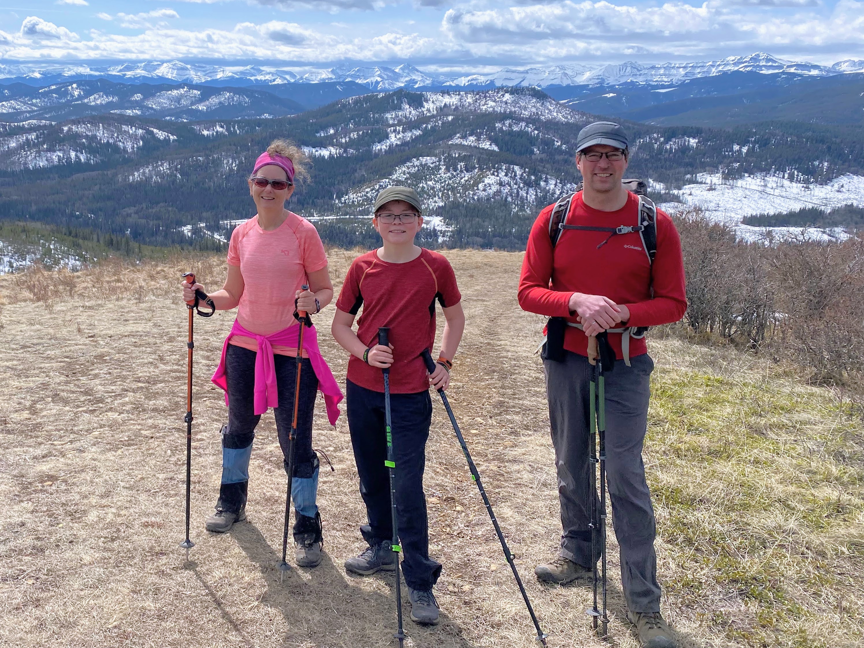
Mesa Butte is a popular spring hike in South Kananaskis, and is the only trail I know that has a fire pit on the summit! The promise of roasted marshmallows or hot dogs should motivate most youth to tromp their way up the Grind, and there are several options for starting points to make this hike as short or as long as you want it to be.
 |
| Mesa Butte dries out early for great spring hiking |
Trailhead Information
Mesa Butte is located south of Bragg Creek near the hamlet of Millarville.
From Calgary, drive southwest to Bragg Creek and then go through the traffic lights continuing to follow Highway 22. You'll come to the junction with Highway 66 where most of us would usually turn right, heading towards Elbow Falls.
This time, you're going to turn left on Highway 22, heading east. You'll be turning off right away on Highway 762 heading south. This quiet country road is paved and you'll follow it to the junction with the Highway 549.
When you reach Highway 549, turn right (west) until the road turns to gravel. And here is where you have your choice of trailheads (see below for more on your choices.)
The route starts at the Petro-Canada gas station west of Calgary at the junction with Highway 22, and from here it is 45 minutes driving time. From my house in West Calgary, it takes us just over an hour to reach the trailhead.
 |
| Several Trails take you to the top of Messa Butte |
 |
| Regardless of which trail you choose, they all finish on the "Grind" |
Trail Options to Reach the Mesa Butte Summit
These options are listed in the order that you'll reach the trailheads driving along Highway 549.
Curley Sands Trailhead - Park in the grassy ditch just off the road past the North Fork Provincial Recreation Area. The trail heads into the trees here. (All Trails link)
This route is 8 km return as an out and back with 470 metres of height gain. The trail climbs to a pretty ridge where you'll reach the summit on Curley Sands Hill. It then drops down to the Curley Connector, losing less than 100 metres of height gain, before climbing up again to the Mesa Butte summit.
Know if you choose this route, you'll have to climb back up and over Curley Sands Hill on the way back. It's not a big climb, but could feel big if you have children who are tired. (We decided to do a loop on our way back to avoid this.)
 |
| Nothing says South Kananaskis like a sign full of bullet holes! |
 |
| Hiking along the Curley Sands Ridge to the top of Curley Sands Hill |
Curley Connector Trailhead - Park at the entrance to the Mesa Butte Provincial Recreation Area and Campground. The trail heads into the trees here. (All Trails link)
This route is 6 km return as an out and back with 228 metres of height gain. It follows a nice ridge all the way to the summit of Mesa Butte.
 |
| Climbing on the Curley Connector Ridge |
 |
| Curley Connector Junction |
Mesa Grind Trail - Drive past the Mesa Butte Campground until you come to a gas well access road and park here. (All Trails link)
This route (according to All Trails) is 4.5 km return with 268 metres of height gain.
My Kananaskis Country Trail Guide has the distance being much shorter, but I'd rather set your expectations for a longer hike and have you pleasantly surprised (rather than the reverse with angry kids.)
 |
| Climbing the Mesa Grind to the summit |
I also encourage you to pick up a copy of the
Kananaskis Country Trail Guide, Volume 4, by Gillean Daffern. She has a fabulous map to the Mesa Butte area in her book with every trail clearly labeled. - Amazon affiliate link
 |
| Mesa Butte is a pleasant spring hike when most trails are still very snowy |
The Mesa Butte Loop that we Hiked
We parked at the Curley Sands Trailhead and followed this trail to the summit of Curley Sands Hill before dropping back down to the Curley Connector Trail.
We climbed the Connector Trail to the summit of Mesa Butte where we met another family enjoying a picnic beside the firepit.
 |
| Forested section descending the Curley Sands Trail to the Connector |
 |
| Climbing the Connector Trail with Curley Sands Hill in the background |
 |
| Climbing the final hill to the top of Mesa Butte on the Grind Trail |
If you want to make a fire to roast hot dogs or marshmallows, be prepared to share the space. You'll also want to bring your own wood or kindling at the very least, a lighter, and a small hatchet if you want. Two shovels were provided so make sure you put out the fire when you leave (which is easy with snow right now.) If the snow has melted, you should be prepared to shovel dirt on the fire to extinguish it and possibly carry in some extra water.
 |
| Summit fire pit (where you'll also find a picnic table) |
From the summit we hiked back down to the junction with the Grind/Traverse/Connector trails and chose to take the Mesa Traverse Trail back to our vehicles. (The kids did not want to climb back up and over Curley Sands Hill.)
 |
| Hiking back down the Grind Trail |
 |
| The Mesa Grind Trail is only steep at the very end |
The Traverse trail crossed through an open meadow below the Butte which was all good, but then it ended in a large muddy clearcut which we followed to a well road, also muddy, eventually coming out on the highway a short distance from our vehicles.
 |
| The Mesa Traverse trail crosses a meadow below the Butte |
 |
| There are markers everywhere in this area to help keep you on trail |
 |
| Crossing the Mesa Traverse Trail |
The loop would be an acceptable option in the dry season but I can't really recommend it now (unless you like mud.) It would be better in spring to hike out and back to the Butte from one of the other trailheads.
 |
| In spring, this is what waits you at the end of the Mesa Traverse Trail |
Our hike was 10.6 km in distance with 472 metres of height gain. (And it's not lost on me that it was actually longer in the end, despite us choosing the loop to make the hike "easier.") Returning the same way would have been 8 km return, even climbing up and over Curley Sands Hill.
You can see our Mesa Butte Via Mesa Traverse loop here on All Trails.
It took us 4 hours to hike the loop at a very relaxed pace, so even though we chose the longest option possible, it was still a relatively short hike.
 |
| The Mesa Butte Trail ends on a well road (most of which is full of mud in spring) |
Hiking the Mesa Butte Trails in Spring
We didn't use spikes or ice cleats when we did this hike (April 16th) but there were still patches of snow and ice on the Curley Sands and Connector Trails.
The Grind Trail was dry, so this should be your first choice if you don't like mud, or are done with snow. (Note we only joined the Grind Trail at the junction with the Connector so it's possible that there is still snow lower down.)
Choosing to hike any of the other trails in the area pretty much guarantees mud (The Mesa Traverse or the Mesa Backdoor Trails for example.)
I recommend wearing gaiters and hiking boots for spring hiking here. Poles will help you with any slippery section, and it's a good idea to have ice cleats in your backpack.
 |
| The Curley Sands, Curley Connector, and Grind Trails are generally dry by mid April |
 |
| Avoid taking the Mesa Traverse Trail in spring - MUD city! |
Reminder before Visiting Kananaskis...
You will need a Kananaskis Conservation Pass to do the Mesa Butte hike. Purchase a daily one for $15 per vehicle or pay $90 for a yearly pass, good for two vehicles at the same address.
And recommended reading:
Read: Spring Hiking Super Guide to the Best Trails in Kananaskis
Read: The Best of Spring in the Canadian Rockies


No comments:
Post a Comment