Showing posts with label Alberta Parks. Show all posts

Friday, January 12, 2024

2024 Campsite Reservation Guide for Alberta and BC

Here we go again! We're still making plans for ski getaways and now it's time to start thinking about the camping season as well. Ready or not, it's time to pull out that calendar and to start planning for the summer.

The May long weekend is coming soon! 

National Park Reservations 


National Park campsites can be booked online for the entire 2024 camping season beginning in JANUARY this year.

Reservations will open in January for the entire 2024 visitor season.

And unlike with provincial parks, there is no 90 day or three month window. You can book any site for a stay during the entire camping season once reservations go live. 

The initial reservation launch date has been staggered by park to ensure that the website doesn't crash.

Below is the reservation launch schedule for national parks near Calgary:


Banff National Park - Friday, January 26th at 8 am MT for front country camping and Monday, January 29th at 8 am MT for backcountry camping.

Scroll further below for more information on day use shuttle bus reservations for Lake Louise and Moraine Lake.

And NEW FOR 2024, The Silverhorn and Rampart Campgrounds on the Icefields Parkway will be fully reservable (no more first come campsites.)


Jasper National Park -  Tuesday, January 30th at 8 am MT for front country camping and Thursday, February 1st at 8 am MT for backcountry camping.


Waterton Lakes National Park - Wednesday, January 24th at 8am MT for front country camping in the Townsite Campground along with backcountry camping.


Kootenay National Park, BC  - Tuesday, January 23rd at 8 am MT for front country camping and Monday, January 29th at 8 am MT for backcountry camping (same as Banff and Yoho for backcountry reservations)


Yoho National Park, BC - Tuesday, January 23rd at 8 am MT for front country camping and Monday, January 29th at 8 am MT for backcountry camping (same as Banff and Yoho for backcountry reservations)

Backcountry Campsites at Lake O'Hara can be reserved online for the entire summer season starting Thursday, January 25th at 8 am MT.

Reservations for guided Burgess Shale hikes go live the same day as front country campground reservations on January 23rd.

Scroll further below for more information on day use shuttle bus service to Lake O'Hara.


Mount Revelstoke National Park, BC - Friday, January 19th at 8 am PT for both front country and backcountry camping


Glacier National Park, BC - Friday, January 19th  at 8 am PT for both front country and backcountry camping

Soon! We'll be camping in the sunshine again soon.


Day Use Shuttle Bus Service for Lake O'Hara in Yoho National Park: 

In 2024, reservations for the Lake O'Hara day-use shuttle will once again be available by way of random draw or lottery. More information on the lottery and shuttle bus service can be found on the Parks Canada website.


And check out my most recent guide: The BEST of Lake O'Hara in a Day!

Visiting world-famous Lake O'Hara requires a lot of luck every year


Day Use Shuttle Bus Reservations for Moraine Lake and Lake Louise in Banff:

Reservable shuttles to Moraine Lake and the Lake Louise lakeshore will be online again for this summer.  Reservations can be made starting Thursday, April 18th at 8am MT.

Reservations can be made on the same website that you use to book campsites.

And note, there is no public vehicle access for Moraine Lake. You'll need to reserve seats on the shuttle bus, take Roam Public Transit, or bike up to the lake. Lake Louise is still accessible, but the parking lot fills up very quickly each day so you're better off taking a bus to reach this destination as well.

Should you decide to drive up to Lake Louise, you'll still have to pay for parking as well, so the shuttle is again, my recommended way of visiting this premier tourist attraction in Banff.


In 2023, the Moraine Lake Road was scheduled to open on May 13th. I recommend watching for the 2024 opening date (for bus access) because it's a lovely bike ride when there are no vehicles on the road. You just have to time your visit so that the snow has melted.

Note the hiking trails will still be snowy in May, so an early season bike ride would purely be an opportunity to view the lake and enjoy a peaceful visit.


For full information on reservations in all parks:

Visit the Parks Canada website. You can also visit individual parks from this link to read up on the campgrounds.

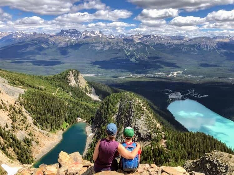
Plan a day hike at Lake Louise or Moraine Lake with shuttle bus tickets for easy access 


Making a Reservation on the Parks Canada website


As of 2021, Parks Canada has gone with a queue system for campsite bookings.

The basic process for booking sites is as follows:
  1. Log in to your Parks Canada account on the day that you can book sites for your chosen park BEFORE 8AM MT (8AM PT for Mount Revelstoke and Glacier.)

  2. You will be placed in the queue and given a random number. You won't know what number you have until 8am when they shuffle everybody in the queue. You may be number 50, you may be number 5000. It is 100% random. 

  3. It does NOT matter if you join the queue at 7:30 or at 7:59. There is no rhyme or reason for your place in the queue.

  4. Make sure you have at least one to two hours of free time to make your bookings. If you have to work, try to find somebody else who has free time that morning to make your bookings for you. If you end up with a high number in the queue, you may be waiting for over an hour to get on the website to make your bookings.

  5. You can not choose your campsite before joining the queue. You can try, but everything will be shuffled at 8am and so anything you had done before this time will be lost. You should still know which sites you are trying to book, but have it written beside you on a piece of paper.

  6. You won't have much time to make your bookings (especially if you have multiple bookings to make.) Make sure your credit card information is handy and know what you're trying to book before you log on to the website.

  7. Most people try to get more than one number in the queue to increase their odds at getting a good number. This is only possible though if you have more than one computer/laptop in the house. You can not just open multiple tabs in the same browser. Every browser shares the same number in the queue. 

    You can however open different browsers on the same computer to get more than one number in the queue. (Example, log in with both Chrome and Safari.) 

    Note, if you do get multiple numbers in the queue, please go with your best number and then close all other browsers so that those numbers can be released to other people trying to book. 

  8. Make sure you're actively monitoring your browser as your number counts down!! If you miss your time to book your campsites, you'll have to join the queue again and you'll be at the back of the line. 
Reservations may be stressful at the time, but worth it come summer!

Other Tips for Getting the Site you Want!


  • You will want to book campsites the day that the reservation system opens for each park and at 8am sharp if planning on camping on weekends during the summer season. There will be more flexibility if camping mid-week or in the spring/fall months.

  • Tag team with friends to get sites you really want (especially if you are looking for sites side by side.)

    Make sure you exchange all booking info. with your friends ahead of time because you can't hold more than one permit in your name for the same date/campground. If booking for friends, you'll want their full name and address. You'll also want to know the size of their trailer or tent along with how many people they will have on their site. (And if you are booking for friends who haven't committed yet, you can change the name on a campsite permit before you show up.)

  • There are still several first come first serve campgrounds in the national parks if you don't get a site.

  • Consider private campgrounds if you can't get into a national park campground or choose provincial park campgrounds just outside the national park.

    For example, in Waterton, you can camp at nearby Beauvais Lake Provincial Park. For Banff, we like camping outside the park gates at the Bow Valley  Campground. There are many private campgrounds in the Radium Hot Springs area if you can't get into Redstreak as well.

  • Make sure there is a fire pit on the site that you are reserving. Some sites in Banff and Jasper do not allow fires.


AND THIS IS THE WEBSITE WHERE YOU MAKE YOUR RESERVATION


Everybody looks forward to that first camping trip of the season!


Alberta Provincial Park Reservations


As of February 12, 2024, Alberta Parks camping reservations will move to shop.albertaparks.ca. Inventory goes live for booking beginning on February 20, 2024.

From the Alberta Parks website:

  • If you already have a shop.albertaparks.ca account, there is no need to make a new account; just be sure to update your account with any changes to your information.

  • If you are a new user you can create an account now. Camping inventory will be available to browse on February 12th.

  • Head to albertaparks.ca/reservations to browse through Frequently Asked Questions and How To Videos and Guides on how to create an account and make a reservation, prior to inventory going live for bookings. 

  • Questions? Call the Call Centre at 1-877-537-2757 for assistance.

  • You will have access to your existing reserve.albertaparks.ca account until February 18th, 2024 to take note of sites you have reserved in the past as this data will not transfer over to the new system.  

  • Reserve.albertaparks.ca accounts and data will NOT be available after February 19, 2024.

Read more about all new updates with Alberta Parks Reservations this year here. 

Grab a group of friends and book some great campsites this summer in a provincial park

Camping Inventory Launch Dates: 


Backcountry reservations launch: February 20 at 9:00 a.m. MST 

Comfort Camping reservations launch: February 22 at 9:00 a.m. MST

Individual Campsites reservations launch: February 26 at 9:00 a.m. MST

Group Camping reservations launch: February 28 at 9:00 a.m. MST  

5,000 First Come First Serve campsites remain available across the province. More information is available at: albertaparks.ca/fcfs


Group camping at Twin Lakes, Crimson Lake Provincial Park

What has NOT changed:

Reservations can be made 90 days in advance for individual and backcountry camping and 180 days in advance for group and comfort camping. 

Once reservations begin, the first date when reservations can be made will be 90 days before the campground’s season opening dates for individual campsites.

Online bookings still open at 9 am MST each day.

It's all worth it come summer when you finally get to go camping

Special Tips:


  • Follow many of the same tips as per national park bookings above. Tag team with friends (especially for group bookings) and pay very close attention to those 90 or 180 day windows!

  • Make sure everything is in your calendar with reminders! I even put reminders beside my computer, my coffee pot, and my bed the night before making a campsite reservation so that I don't accidentally forget.

  • If you don't get the site that you want, there are plenty of first come first serve campgrounds. Many campgrounds also have a small number of  FCFS campsites. A Full List of FCFS Campgrounds can be found here.

  • Consider booking a group site if you have at least 5 families coming with you. You'll get your own private campground or group area and will have lots of room for the kids to run around and play.

    Note that most group sites do not have power or services for RVs so you'll have to either bring generators or camp off the grid as we do. Most group sites can be booked with a payment for 5 units but some require payment for 10 units so make sure you check the details before reserving a site. Full info. on group camping can be found here.


Spring Camping in Dinosaur Provincial Park

Important Links:

Alberta Parks Online Reservation Information

Comfort Camping in AB Parks  

Backcountry Reservations


AND THIS IS THE WEBSITE WHERE YOU MAKE YOUR RESERVATION: Reservation website 


Peter Lougheed Provincial Park is a beautiful place to camp in Kananaskis 


British Columbia Provincial Park Reservations


BC Parks launched a new reservation service in 2022, so if it's been a few years, you'll have to create a new account.


And reservations can be booked 4 months in advance of all trips (which is very different from Alberta Provincial Parks.) You'll be able to book sites for the May long weekend in January.

Backcountry permits are also available to reserve 4 months in advance of your trip.

And all new sites become available in the system at 7am PT each morning.

- and note that the Berg Lake Trail was closed for the 2023 season. Information has not been released yet for 2024 so visit the BC Parks website for updates.

And group campsites can be booked a full year in advance.


Beach life at Kokanee Creek Provincial Park, West Kootenays


Using the BC Parks Booking System

Online bookings open at 7 am PT each day and can be made on the BC Parks Reservation website.

** And note that BC Parks has also gone to the queue system so you may have to wait to get onto the parks reservation website in the morning.

Read more about the queue system under national park bookings above.


Reservations are NOT Transferable once Booked 

"Reservations are not transferable. Reservation holder name(s) ("Occupant Name" and alternate "Optional Authorized Person") must be provided at the time of booking and cannot be added or changed later. Any reservation holders found to be transferring or selling their reservations to another party, risk their reservation being cancelled without a refund. If a customer can no longer use their reservation, they are encouraged to cancel it so that any unused camping fees that are not forfeited as a penalty, can be refunded to the credit card that was used to make the original reservation."


And know that at least ONE of the reservation holders must be present upon arrival and during the stay. ID may be required to prove you are the reservation holder. - So don't think you can just sell your site to another family and have them "pretend" to be you. 


You can not reserve extra nights to "save" a site

And if you think you can book early, accept you'll get no refund for un-used nights, and just show up on Friday night, that isn't going to work!

"Reserved sites are held until 11 AM the day after the scheduled arrival date. If you do not notify the park operator directly of a late arrival, you will be considered a no-show and your reservation will be cancelled." - and your site will be given away!


And, pay close attention to the restricted booking window!

"If your reservation is made on the first day of the four-month booking window, you cannot change your dates. For example, if your arrival date is July 1 and you booked on March 1, you cannot change the arrival or departure date."

Imagine scoring a campsite here!


Camping in BC provincial parks over Long Weekends

To make a reservation for a statutory holiday weekend, you are required to book a minimum of 3 nights.

The nights you must camp are below for 2024:

Victoria Day: Monday May 20, 2024 (Friday, Saturday, and Sunday nights)

Canada Day: Monday, July 1, 2024 (Friday, Saturday, and Sunday nights)

BC Day: Monday August 5, 2024 (Friday, Saturday, and Sunday nights)

Labour Day: Monday September 2, 2024 (Friday, Saturday, and Sunday nights)

Thanksgiving: Monday October 14, 2024 (Friday, Saturday, and Sunday)


Follow this link for information on making reservations


For Bookings, Follow this Link to BCParks.ca 


The are some amazing places to camp across British Columbia!

Other Suggested Reading 


Camping Super Guide - This is a quick guide to all of my popular camping stories for easy reference and reading. I add to this page regularly.

Notable stories to check out:

How to Choose a Good Campsite (Family Camping Made Easy) 


Wednesday, April 19, 2023

Mesa Butte - Family Hiking in Kananaskis

Mesa Butte is a popular spring hike in South Kananaskis, and is the only trail I know that has a fire pit on the summit! The promise of roasted marshmallows or hot dogs should motivate most youth to tromp their way up the Grind, and there are several options for starting points to make this hike as short or as long as you want it to be.

Mesa Butte dries out early for great spring hiking


Trailhead Information


Mesa Butte is located south of Bragg Creek near the hamlet of Millarville.

From Calgary, drive southwest to Bragg Creek and then go through the traffic lights continuing to follow Highway 22. You'll come to the junction with Highway 66 where most of us would usually turn right, heading towards Elbow Falls.

This time, you're going to turn left on Highway 22, heading east. You'll be turning off right away on Highway 762 heading south. This quiet country road is paved and you'll follow it to the junction with the Highway 549.

When you reach Highway 549, turn right (west) until the road turns to gravel. And here is where you have your choice of trailheads (see below for more on your choices.)

See the route on Google Maps here which takes you to the Mesa Butte Provincial Recreation Area.
The route starts at the Petro-Canada gas station west of Calgary at the junction with Highway 22, and from here it is 45 minutes driving time. From my house in West Calgary, it takes us just over an hour to reach the trailhead.

Several Trails take you to the top of Messa Butte

Regardless of which trail you choose, they all finish on the "Grind"


Trail Options to Reach the Mesa Butte Summit


These options are listed in the order that you'll reach the trailheads driving along Highway 549. 

Curley Sands Trailhead - Park in the grassy ditch just off the road past the North Fork Provincial Recreation Area. The trail heads into the trees here. (All Trails link) 

This route is 8 km return as an out and back with 470 metres of height gain. The trail climbs to a pretty ridge where you'll reach the summit on Curley Sands Hill. It then drops down to the Curley Connector, losing less than 100 metres of height gain, before climbing up again to the Mesa Butte summit.

Know if you choose this route, you'll have to climb back up and over Curley Sands Hill on the way back. It's not a big climb, but could feel big if you have children who are tired. (We decided to do a loop on our way back to avoid this.)

Nothing says South Kananaskis like a sign full of bullet holes!

Hiking along the Curley Sands Ridge to the top of Curley Sands Hill

Curley Connector Trailhead - Park at the entrance to the Mesa Butte Provincial Recreation Area and Campground. The trail heads into the trees here. (All Trails link)

This route is 6 km return as an out and back with 228 metres of height gain. It follows a nice ridge all the way to the summit of Mesa Butte.

Climbing on the Curley Connector Ridge

Curley Connector Junction

Mesa Grind Trail  - Drive past the Mesa Butte Campground until you come to a gas well access road and park here. (All Trails link)

This route (according to All Trails) is 4.5 km return with 268 metres of height gain. 

My Kananaskis Country Trail Guide has the distance being much shorter, but I'd rather set your expectations for a longer hike and have you pleasantly surprised (rather than the reverse with angry kids.)

Climbing the Mesa Grind to the summit

You can see a map on the Kananaskis Trails website here which shows the parking lots for the Curley Connector and Mesa Grind Trailheads.

I also encourage you to pick up a copy of the Kananaskis Country Trail Guide, Volume 4, by Gillean Daffern. She has a fabulous map to the Mesa Butte area in her book with every trail clearly labeled. - Amazon affiliate link 

Mesa Butte is a pleasant spring hike when most trails are still very snowy

The Mesa Butte Loop that we Hiked

We parked at the Curley Sands Trailhead and followed this trail to the summit of Curley Sands Hill before dropping back down to the Curley Connector Trail.

We climbed the Connector Trail to the summit of Mesa Butte where we met another family enjoying a picnic beside the firepit. 

Forested section descending the Curley Sands Trail to the Connector

Climbing the Connector Trail with Curley Sands Hill in the background

Climbing the final hill to the top of Mesa Butte on the Grind Trail

If you want to make a fire to roast hot dogs or marshmallows, be prepared to share the space. You'll also want to bring your own wood or kindling at the very least, a lighter, and a small hatchet if you want. Two shovels were provided so make sure you put out the fire when you leave (which is easy with snow right now.) If the snow has melted, you should be prepared to shovel dirt on the fire to extinguish it and possibly carry in some extra water. 

Summit fire pit (where you'll also find a picnic table)

From the summit we hiked back down to the junction with the Grind/Traverse/Connector trails and chose to take the Mesa Traverse Trail back to our vehicles. (The kids did not want to climb back up and over Curley Sands Hill.)

Hiking back down the Grind Trail

The Mesa Grind Trail is only steep at the very end

The Traverse trail crossed through an open meadow below the Butte which was all good, but then it ended in a large muddy clearcut which we followed to a well road, also muddy, eventually coming out on the highway a short distance from our vehicles.

The Mesa Traverse trail crosses a meadow below the Butte

There are markers everywhere in this area to help keep you on trail

Crossing the Mesa Traverse Trail

The loop would  be an acceptable option in the dry season but I can't really recommend it now (unless you like mud.) It would be better in spring to hike out and back to the Butte from one of the other trailheads.

In spring, this is what waits you at the end of the Mesa Traverse Trail

Our hike was 10.6 km in distance with 472 metres of height gain. (And it's not lost on me that it was actually longer in the end, despite us choosing the loop to make the hike "easier.") Returning the same way would have been 8 km return, even climbing up and over Curley Sands Hill.

You can see our Mesa Butte Via Mesa Traverse loop here on All Trails.

It took us 4 hours to hike the loop at a very relaxed pace, so even though we chose the longest option possible, it was still a  relatively short hike. 

The Mesa Butte Trail ends on a well road (most of which is full of mud in spring)


Hiking the Mesa Butte Trails in Spring 

We didn't use spikes or ice cleats when we did this hike (April 16th) but there were still patches of snow and ice on the Curley Sands and Connector Trails.

The Grind Trail was dry, so this should be your first choice if you don't like mud, or are done with snow. (Note we only joined the Grind Trail at the junction with the Connector so it's possible that there is still snow lower down.)

Choosing to hike any of the other trails in the area pretty much guarantees mud (The Mesa Traverse or the Mesa Backdoor Trails for example.)

I recommend wearing gaiters and hiking boots for spring hiking here. Poles will help you with any slippery section, and it's a good idea to have ice cleats in your backpack.

The Curley Sands, Curley Connector, and Grind Trails are generally dry by mid April

Avoid taking the Mesa Traverse Trail in spring - MUD city!


Reminder before Visiting Kananaskis...

You will need a Kananaskis Conservation Pass to do the Mesa Butte hike. Purchase a daily one for $15 per vehicle or pay $90 for a yearly pass, good for two vehicles at the same address.


And recommended reading:

Read: Spring Hiking Super Guide to the Best Trails in Kananaskis 

Read: The Best of Spring in the Canadian Rockies 


Monday, October 18, 2021

First Summits - Mount Burke to the Cameron Fire Lookout, Kananaskis

This has been the summer of visiting fire lookouts for us (three so far by September.) Mount Burke gave us the opportunity to visit the historic Cameron Fire Lookout in Southern Kananaskis, decommissioned in 1953 when the Raspberry Ridge lookout was built instead.

Reaching the summit of Mount Burke and the Cameron Fire Lookout


Stats for the Hike 

Distance:  11 km return


Height gain
: 900 metres 


Time it took us to complete the return hike: 
It took us 5.5 hours (just over 4 hours moving) with two youth ages 10 and 12.


Best time to do this hike: This trail is accessible between May 15th - September 1st each year when the gate is open past the Cataract Creek Day Use Area. After that it is still possible to hike to the summit in later fall (or early spring,) but you'll have to walk an extra 1.7 km return from the gate. (Bring a bike and a lock.)


Rating
: This is an intermediate hike. While the trail is steep at times, there's always a well defined trail and you'll never have to use your hands to scramble up anything. There is no exposure. Note that this is still an "unofficial trail" meaning there are no signs along the way to guide you.


Best Guide Book
Kananaskis Country Trail Guide, Volume 5, Gillean Daffern - Amazon affiliate link 


All Trails Link 
- Mount Burke on All Trails. I recommend using the All Trails app so you know where to park at the Cataract Creek Campground in South Kananaskis. Once you get on the trail though it is relatively easy to follow it all the way to the summit.

Note to download the map, you'll need to have a premium paid subscription. I find it to be worthwhile, even just so I can see how far I am from the summit every time somebody asks "how much further?" 

The Cameron Fire Lookout on Mount Burke in Southern Kananaskis


Parking at the Cataract Creek Campground


The trailhead for Mount Burke is at the entrance of the Cataract Creek Campground (Google Maps link.) The campground is south of Highwood Junction at the intersection of Highway 40 and Highway 541 west of Longview.

You can either access the area from Longview or from Highway 40, driving all the way south past Kananaskis Village and over Highwood Pass. At Highwood Junction you turn south on the Highway 940.

Note if you are choosing  to access the trail via Highway 40 from the north, there is a gate past the junction for the Kananaskis Lakes and it's closed between December 1st and June 15th each year. You likely won't be hiking up Mt. Burke in winter, but if you're doing an early spring hike, make sure you drive down south towards Longview.

And as mentioned earlier, there is a gate just off the Highway 940 at the Cataract Creek Day Use Area until May 15th when the campground opens. It closes again on September 2nd when the campground again closes for winter. When the gate is closed you have to walk down a short road to the trailhead (1.7 km return.)

Once you get inside the Cataract Creek Campground there is a small parking lot on the right hand side of the access road that has a sign for Mount Burke.

Mount Burke as seen from the parking lot at Cataract Creek


Step One: Parking Lot to Ridge Line


This was the most painful part of the hike for me, and honestly why we probably won't repeat this hike very often. Once you reach the ridge, the hike is gorgeous! Getting to the ridge however is a loooong boring slog through the trees.

I still recommend doing this hike at least once though because it is very beautiful once you get up to the ridge, the fire lookout is very cool to see, and as with all things, the best achievements have to be worked for. It's also a great spring hike when you're ok with a long hike through the trees because it feels so good to just be hiking again.

Hiking towards Mount Burke out of the parking lot

The hike starts with a flat walk across a meadow out of the parking lot. You then climb up through the forest where the trail has a couple of short steep hills (in both directions.)


You can see the trail as it follows along the edge of the trees above

Then, comes the part that honestly sucks. I don't think I'll get any opposing opinions here. Bring candy because you're going to be heading up an old cut line (in a complete straight line) which goes up with no switchbacks, no turns, no views... just straight up for a full kilometre! And it's steep at times!

There's also one hill that you'll have to climb back up on the return. (Save some candy!)

Head down, straight up for a kilometre here

Finally, however, you get to the switchbacks and then the grade eases up a bit. Apparently there are ~ 30 switchbacks, but it felt like 100. Thankfully they weren't that steep and it was actually a great way to make progress climbing the mountain.

The switchbacks were annoying on the way down though because they were too gradual and we wanted a more "direct" route. If that's you too, you will find short cuts through the trees which bypass the switchbacks. (I'm not sure if it's recommended to take them or not, but I'll leave that to you.)

I didn't actually take a single photo of the switchbacks because trees, more trees, and just more trees. Thankfully my girlfriend took the photos above because I actually didn't take a single photo until we reached the ridge. (I guess I wasn't inspired until then.)

Hiking distance from parking lot to the ridge: 4 km. So allow for 90 minutes to reach the ridge at a good pace. This does however mean that you'll have 4 km of "boring" hiking before you reach the 1 km of good hiking. Thankfully that one kilometre is spectacular so keep reading. 

We finally reached the ridge and it quickly becomes much rockier

Step Two: Climbing the Ridge to the Summit of Mount Burke


The final kilometre becomes more scrambly but you'll never have to use your hands. There's always a good trail through the rock, and the ridge is never overly exposed. Best of all, there's no nasty scree. This is always a hike.

Starting up the ridge where the views finally appear

Following a good rock trail up the ridge

You'll know you're almost there (maybe 100 metres vertical to go) when you get your first good glimpse of the final push to the summit and the lookout.

Chances are you'll stop here, and at least one person in your group will loudly scream "I have to climb up there?!!" 

Rest assured it's not as bad as it looks in the photo below and there's always a good trail through the rock and scree.

Our first glimpse at the final approach to the summit

The final trail up to the summit of Mt. Burke

Reaching the historic Cameron Fire Lookout on Mt. Burke


Mount Burke Summit 


Everybody loves fire lookouts (they do tend to have good views after all, typically being perched on top of mountains.) The Cameron Lookout is no exception and it really makes you wonder how somebody could live in this tiny little shack for at least 4 months out of the year, all alone! There are no trees so the house would have been completely exposed and at the mercy of every storm that blew through. (No thank you!)

The lookout looks a little worse for wear since being decommissioned in 1953

Careful where you walk inside the lookout

The Cameron Fire Lookout perched on top of Mt. Burke

We truly lucked out upon reaching the summit after hiking up the trail in thick smoke from forest fires. The smoke lifted and the sun came out as we approached the top allowing us to enjoy our summit experience and the gorgeous views.

This is why you hiked all the way up here!

Fire lookouts are amazing destinations for a family hike!

The Return Hike Down from Mt. Burke


Maybe it's just me, but I tend to take a LOT more photos on the hike down because I can finally breathe, relax a bit, keep up to my son, and actually feel motivated to stop without the pressure of reaching the summit.

Enjoying the interesting ridge walk on our way along the Mt. Burke trail

Hiking down along the ridge (You go up and over the hump in the background)

On this particular hike the sun had finally cleared away the smoke too so suddenly we had amazing views for the return trip down the mountain. (We probably took more time on descent than we did on the way up because we stopped so often to take photos!)

The hike goes up and over the bump in this photo as you hike along the ridge

Hiking along the ridge of Mt. Burke with all the misty mountains in the background

On this particular day, the surrounding mountains had an ethereal look to them, all misty and layered with dozens of unique shades of blue! I had no idea blue had so many different hues.

Looking back up at the summit, the fire lookout, and the final approach

A brief narrow section on the ridge was my fav. part of the entire hike

There was one short section along the ridge where it gets narrower and this was my favourite part of the entire hike. It wasn't exposed, but you actually felt like you were on a ridge! And there were dozens of fantastic photo opportunities in this section (as in the photo above.)

One final look back at the summit of Mt. Burke

Back down to the grassy slopes at the bottom of the ridge (and about to head into the trees)

The photo above is the last one I got before we hit the trees again because motivation to reach the parking lot was renewed once we left the views behind. It took us about an hour to bomb down the trail from this point.

Want to discover more first summits to tackle in the Canadian Rockies?