Showing posts with label Elbow Valley. Show all posts

Tuesday, May 07, 2024

Canyon Creek Ice Cave - Spring Hiking in Kananaskis

This has become my new favourite spring hike, and while it would be a great hike any time of the year, spring is magical when there is actual ICE in the ice cave. Visit later in the season, and it's just a cave (still cool, but not exactly an "ice" cave.)

There's no better spring adventure than biking and hiking to an ice cave!

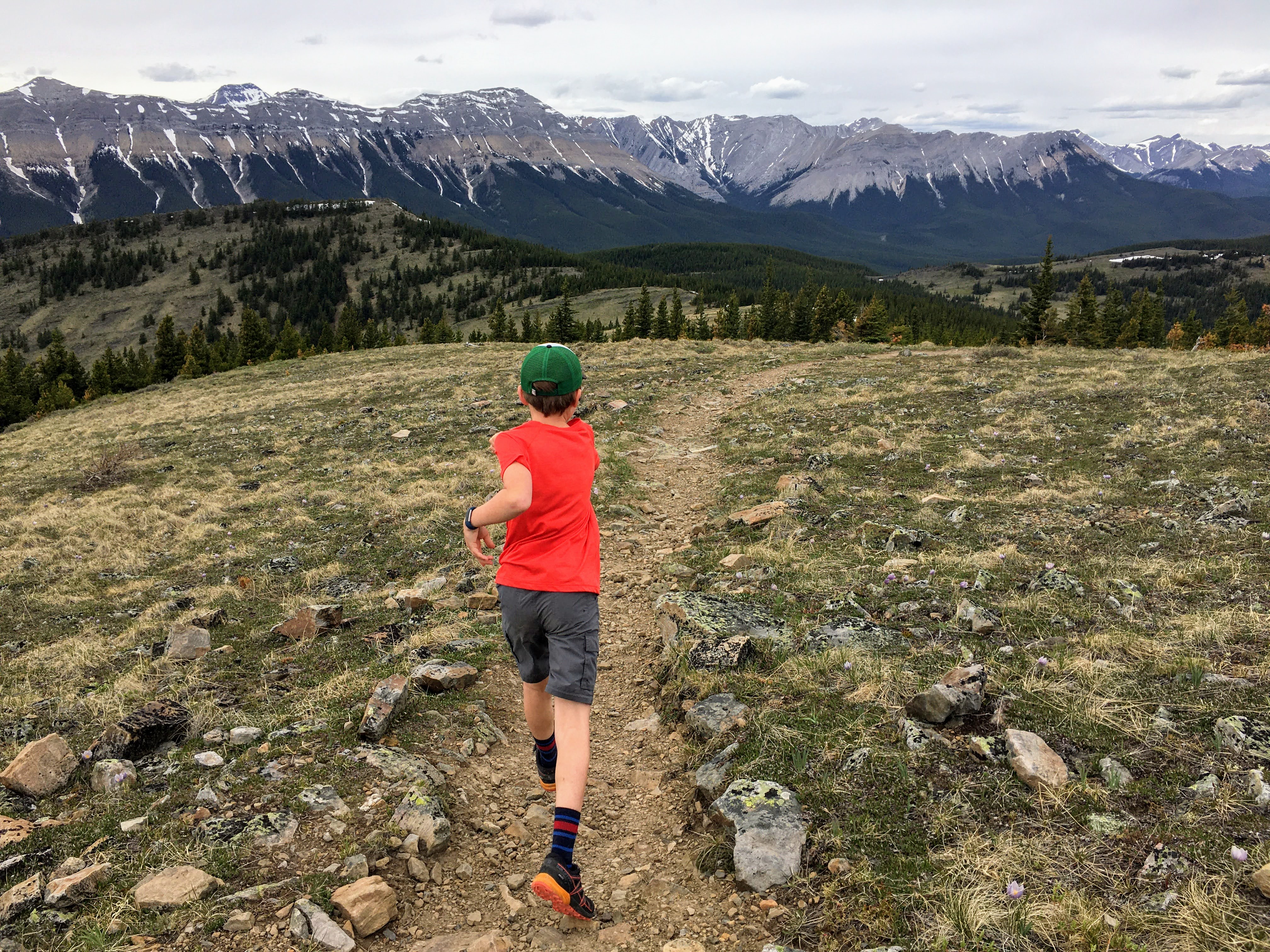
When the trail is dry, the hike is generally family-friendly for experienced youth who have done intermediate/advanced hikes with some easy scrambling. I wouldn't recommend it with babies or young children (for rock fall hazard alone,) and to fully enjoy every aspect of the trip, you're going to need bikes to access the trailhead.

Canyon Creek Ice Cave Adventure in Kananaskis


Stats for the Hike

Distance: You'll bike or hike 5.5 km on a gravel road. After that, you'll hike ~1.5 km to reach the cave. All added up, your adventure will come to roughly 14 km round trip.


Height gain: 450 metres including the height gained/lost on the gravel access road. The road gains about 75 metres and the rest is gained on the steep hiking trail.


Time it takes to complete the hike: It really depends on whether you hike or bike the gravel road, and how much exploring you do in the cave. At a fast pace (with a bike) you could complete the hike in 3 hours. Most people will spend significantly longer on the adventure though.


Rating: The actual hiking trail is steep and scrambly at the top. Hiking inside the cave is very rough (and slippery when there's ice.) For these reasons, I'd rate this as an intermediate/advanced adventure.

Most fit adults (or youth) should have few problems getting to the cave if they are with a strong group of hikers, and this trip is definitely a "crowd favourite" if wanting to introduce friends to hiking. Everybody loves a good adventure, and caves are fun to explore (even if novice hikers have to slide down a few sections at the top on their bums to descend the steep trail.)

The entrance to the Canyon Creek Cave is pretty spectacular!


Best Guide BookKananaskis Country Trail Guide, Volume 2, Gillean Daffern - Amazon affiliate link 


All Trails Link: Canyon Creek Ice Cave


* All hiking distances are approximate

Visit the cave in spring when there's actual ICE


Trailhead Information 

The trail starts from the Ing's Mine parking lot off Highway 66 in the Elbow Valley west of Bragg Creek.

You can see the Google Maps link here.

The Canyon Creek Road is open as far as the parking lot. Beyond that, there is a gate, and I highly recommend bikes for the next 5.5 kilometres of distance to reach the true trailhead for the cave hike.

The Canyon Creek Road is accessible year round, and is located before Elbow Falls where there is a highway gate that doesn't open until May 15th. 

Such a fun adventure for a group of friends


Hiking or Biking the Canyon Creek Road to the Ice Cave Trailhead 


The gravel road portion of the trip would be mind numbingly boring to walk, and is therefore best done with bikes. If hiking, make sure you bring a lively group to chat with.

With bikes, there are a couple of hills that children or novice riders may need to walk. I walked a couple myself since it was one of my first rides of the season and my lungs weren't in biking shape yet. The road is generally easy to bike though, and is just a wide gravel road. This isn't mountain biking, and you'll do fine with a simple gravel bike or mountain bike if you prefer.

Even if you end up walking a hill or two with your bike, it's still preferable to walking the entire 11 km round trip distance (on a road!!)

Bring a bike, and the trip out is very FAST because it's relatively downhill coasting on the way back to the parking lot.

When you reach the end of the gravel road, lock your bikes up, and switch to hiking mode. There are no bike racks, but we just locked our bikes to trees beside the road where there was a nice clearing beside the trailhead.

Biking the Canyon Creek Road (not something I want to hike for 11 km round trip!)

Hiking to the Canyon Creek Ice Cave

There's a decent trail that you can follow all the way to the cave, but I do recommend downloading the map if you have a premium subscription to All Trails, just for the peace of mind as the trail is braided in a few spots closer to the cave.

The ending is steep but manageable on a good trail

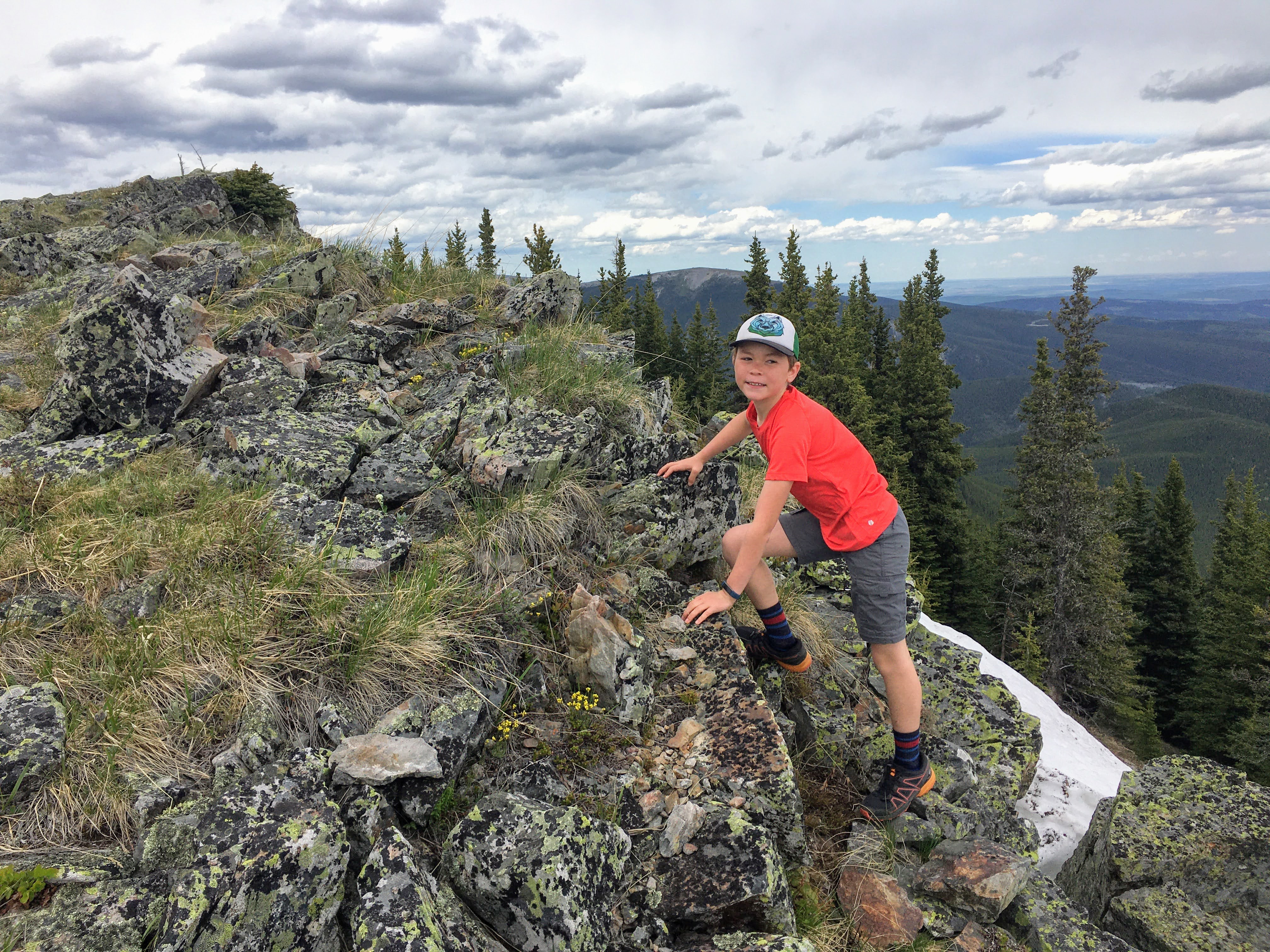
The trail has a few steep spots, but is generally quite pleasant to follow through the trees until you reach the scree slope below the cave. Once you reach the final section, it becomes much steeper, more scrambly, and there are a few blocky steps to climb up. (On the way down I had to lower myself from my bum a few times.)

Approaching the cave after a short 45 minute hike from the end of the road

As far as "scrambling" goes, this is a very easy scramble. There is no loose scree and you'll never feel like your feet are going to skitter out from underneath you. 

If the trail is snow covered, ice cleats or spikes would be imperative.

Arriving at the cave after a bike and hike adventure


Exploring Inside the Cave


I recommend helmets for exploring inside the cave, and you should have them on as you approach the cave as well because people can knock rocks down from above. I visited mid-week with friends when we had the cave to ourselves so it was less of a worry. On a weekend though it could be a different story. - And in a pinch, just wear your bike helmets if you rode up (no need to bring two helmets.) Or, bike in a climbing helmet.

There are no shortage of fun photos you can take inside the cave

We enjoyed seeing so much ice in the cave!

You'll also need good headlamps for this adventure. There's lots of light near the cave entrance, but as you go further, it becomes very dark. 

Ice pillars and giant icicles inside the cave 
And a final word of caution about hiking in the cave: Exercise extreme caution when walking around. Many of the rocks are covered in ice and are also polished from thousands of boots walking over them.

This is where that headlamp becomes super important so you can see the ice covered floor sections of the cave.

Bring headlamps to explore the cave!

Spring is a great time to visit this ice cave

Hike as far back into the main chamber of the cave as you want, and then if you're feeling brave, you can crawl into a few other smaller chambers. For this, I really do recommend helmets. (Ignore our bad example in the photos below.)

Crawling around at the back of the main chamber

This is definitely my new favourite spring hike

The Hike and Bike Out from the Cave 


On descent, I found the trail to be much trickier near the cave entrance, but a pair of poles and slow maneuvering got us down safely.

The descent from the cave is steep so take your time

The descent starts off steep but the angle eases as you descend

The bike ride on the way out was exceptionally fast! We just had to climb up the first hill from the end of the road, and then it was a beautiful ride back down to the parking lot. I can't even imagine hiking back down the road.

Our happy group at the Canyon Creek Ice Cave 

We enjoyed a fast bike ride back down the road 

Returning for the Family Version 


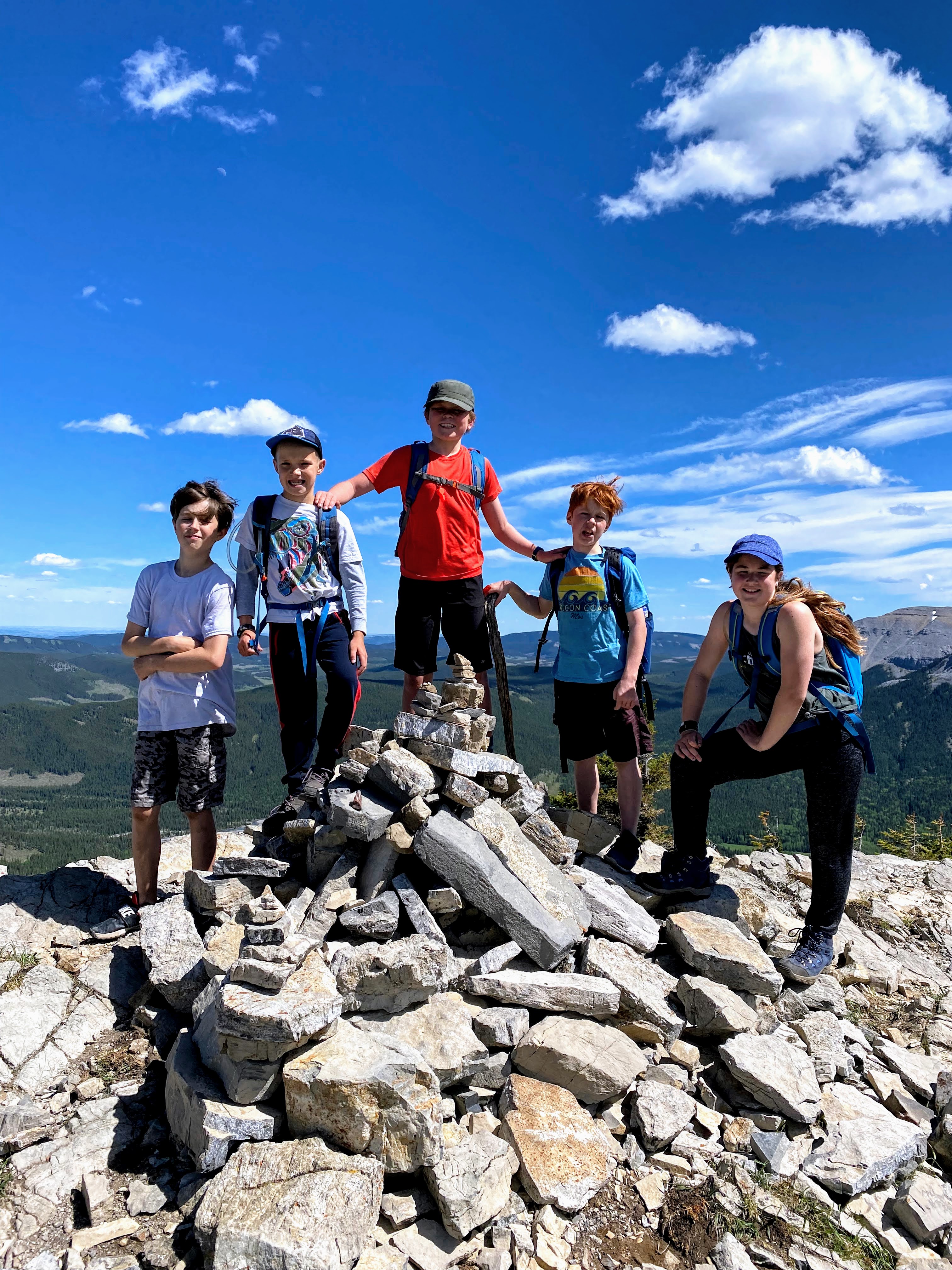
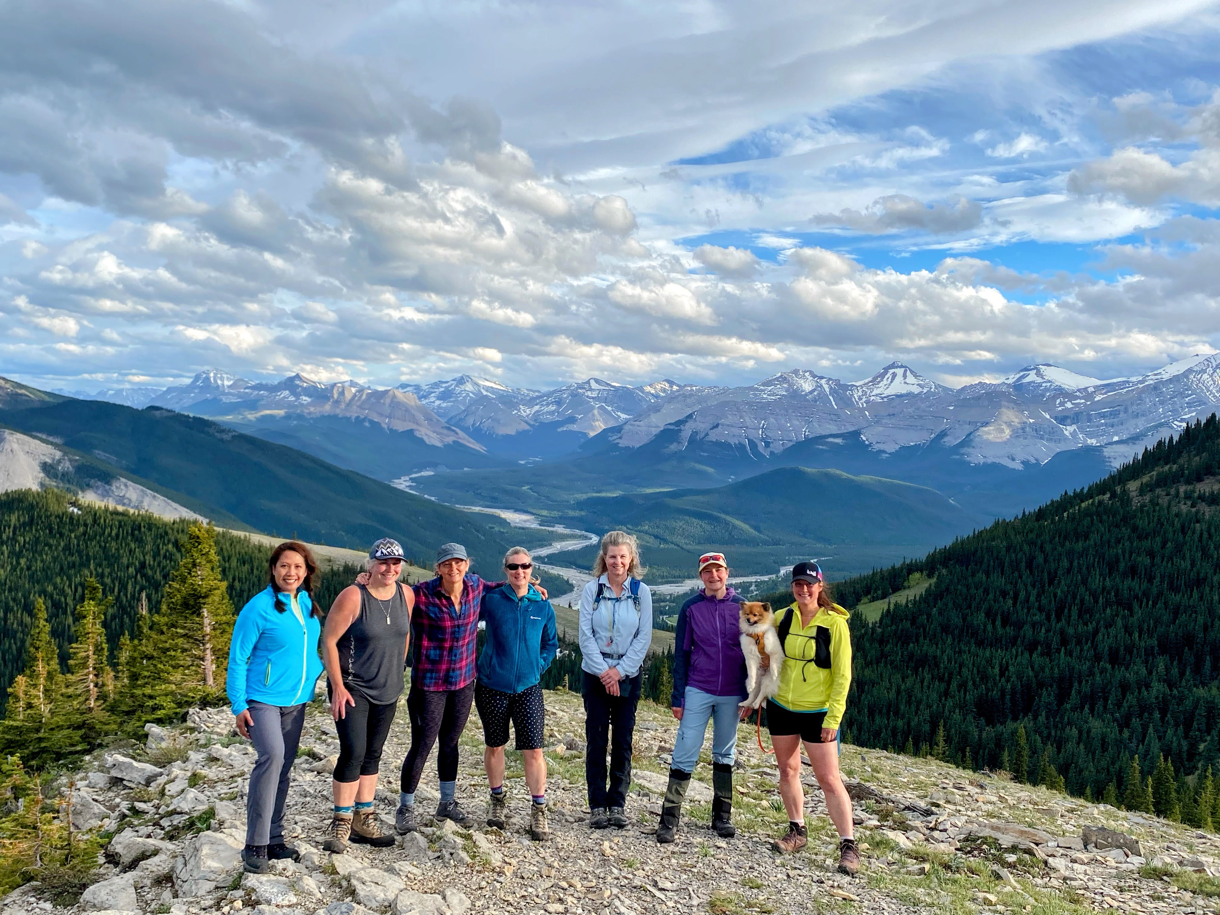
I visited the cave mid-week with girl friends, but my son was ticked when he looked through my photos, and I knew there would be no forgiveness until he'd had the chance to visit the cave too.

My son HAD to visit the cave himself after seeing my photos!

I wasn't quite up for a second cave adventure in the same week, so my husband happily took him on the weekend. They got a very early start, biked up the road, and beat the weekend crowds.

Safe to say most kids will LOVE this adventure.


Every child's dream hike!


Other Recommended Reading for Spring Hikes


Thursday, August 18, 2022

Powderface Ridge - Family Hiking and First Summits in Kananaskis

There are very few hiking trails that I would repeat annually, but Powderface Ridge is one of them. We keep finding new and creative ways to hike this trail, and it never really gets old as a destination. It's the perfect first summit for families, and there are several options to make the trip as short or as long as you want it to be.

Powderface Ridge sunset hike in June (photo: Joyce Cortes)

The Official Trailhead and Route up Powderface Ridge


This official trailhead for this ridge starts at the end of highway 66 in the Elbow Valley where the pavement ends (right before you drive into the Little Elbow Campground.) From this parking area it's a steep 600 metre climb (13 km round trip distance.)

You can read about the official trail and see a map on the Kananaskis Trails website. And if you have a copy of the Kananaskis Country Trail Guide, Volume 2, by Gillean Daffern you can read all about the trail there (Trip 31.)

And note, the highway only opens on May 15th each spring so while this is a great spring hike, wait until the road is open past Elbow Falls. 

This large boulder begs to be climbed while hiking up or down the Powderface Ridge trail

My personal opinion about the official trail for Powderface Ridge can be summed up in one word: DOWN. This is a great way down from the ridge. It sucks as a climbing route. I like doing a one-way shuttle for this hike, starting high and ending low.

I have hiked Powderface Ridge many many times, but I've never climbed up the official trail because I don't seen a point in starting at the lowest point possible to access the ridge, especially when there are two other routes that both start much higher!

Powderface Ridge is a beautiful ridge in the Elbow Valley

Powderface Ridge via Three Trail Pass 


For an easier outing, we always do a traverse (with a car shuttle) via Three Trail Pass allowing us to gain only 400 metres of height, hiking across the ridge, and descending the official trail in a complete distance of approximately 8 km.

To access this shortcut trail and by far the easiest access for the ridge, turn right on to the gravel Powderface Trail (road) when you get to the Little Elbow Campground and the end of the paved Highway 66.

You'll enjoy a long meadow traverse to the summit of Powderface Ridge from Three Trail Pass

Drive up the Powderface Trail road for approximately 6 km until you reach Sacramento Pass. You can see the Google maps location for the Three Trail Pass trailhead here. 


Note the All Trails link above has you starting at Highway 66 but this is where you want to END. You want to start high, finish low. You should be starting from the Powderface Trail road and then ending on Highway 66 at the entrance to the campground.

Because the All Trails version of this hike is done in reverse, the numbers for height gain will be off. The distance is also a bit high.

Follow this link to a good description from the Alberta Parks website (where there is a good map showing both trailheads.)

There are lots of fun scrambly rocks at the summit of Powderface Ridge

Route Description for the Powderface Ridge Traverse


From Powderface Trail, you'll begin by hiking a kilometre on an old road /double track trail to a three-way junction, climbing a gradual 150 metres of height. This is Three Trail Pass and here you'll turn right to climb up to the ridge. Don't go straight or you'll find yourself heading along the Powderface Creek trail which ends by Elbow Falls! It's a great mountain biking trail but not too fun as a hike.

The trail climbs a rocky wide road to Three Trail Pass

From Three Trail Pass the hike starts to get more beautiful as you climb up and through grassy meadows to gain the ridge  and official summit for Powderface Ridge. This section is approximately 2 km in length and you'll gain another ~ 150 metres of height. The hiking is never steep and the ridge is not narrow.

Three Trail Pass with the ridge visible above

Either turn around once you reach the summit or (if you've set up a vehicle at the far end) continue hiking towards the exit trailhead on Highway 66.

Powderface Ridge is a beautiful hike in the Elbow Valley

And this is where I mention that all distances and height gain references in this guide are approximate numbers! I've used several different guide books, websites, and apps to create this guide, and every single one is slightly different!

Early season snow on the ridge crest 

From the ridge, drop down off the opposite side of the ridge, following the trail that descends from the summit. You don't have to traverse the ridge very far before you'll see the trail leaving the ridge.

If you hike this trail early season there may still be snow on this section requiring you to kick steps as you descend off the ridge (or follow steps others have made.) Once below the ridge crest, the snow disappears.

Descending the ridge on early season snow

The trail loses 100 metres of height over the next couple of kilometres as you descend through trees without views. At the bottom, you'll arrive in another large meadow and you have the option of climbing up to the East Summit. It's a quick "run up and down" with less than 50 metres of climbing to reach this summit, and in my opinion it is highly worth it for great views over the Elbow Valley. This summit also feels more like an official summit than the one on the ridge top.

Tag the East summit if you want, or continue your hike through the meadow and down the official Powderface Ridge trail to the trailhead on Highway 66. This is where you'll lose another 400 metres of height over 3.5 km.

The trail down from the meadow travels through trees much of the time without views. It is never overly steep, and the trail is good, but those with bad knees will definitely know they are descending!

East summit of Powderface Ridge

Easy Peasy Shortest Hike Possible for Powderface Ridge 


Start and end your hike via Three Trail Pass for the easiest hike (6 km round trip.) 

This is a great one with young kids or as a half day hike.

It's only 6 km round trip to tag the official summit via Three Trail Pass

Powderface East Ridge Trail from Rainy Creek Summit 


For an alternate (shorter route) to the East Summit, you can start from Rainy Creek Summit and take the East Ridge Trail off Highway 66 for a short 4 km round trip outing with 400 metres of height gain.

The East summit feels most like a real "summit" and it's a great evening hike. Note the East Ridge Trail is steeper than the route via Three Trail Pass. You'll also be hiking along a rocky ridge for a bit where the terrain could feel a bit scrambly for some.

Hiking up the Powderface East Ridge Trail

To extend your hike, drop a small amount of height and then climb up the regular Powderface Ridge Trail to gain the official summit for a double summit day. Return the same way via  the East Ridge Trail.

Tagging both summits from the East Ridge Trail would amount to ~ 150 metres of extra climbing and 4 extra kilometres of hiking.

See the Google Maps location for Rainy Creek Summit where you'll park here. 

Youth hike up the Powderface East Ridge Trail to the East Summit

Alternate Traverse: Three Trail Pass to Rainy Creek Summit 


This traverse is still on my list for the next time I head out to hike Powderface Ridge. Start high on Powderface Trail and approach the ridge via Three Trail Pass. Then end high as well by finishing at Rainy Creek Summit (which sits at a much higher elevation than the regular trailhead on Highway 66 at the end of the road.)


This route is only 9.5 km long with an easy 450 metres of climbing! (SCORE!)

Girls night out on the East Powderface Summit


Read more about Hiking in the Elbow Valley 


Wednesday, May 26, 2021

White Buddha and Vents Ridge - Family Hiking in Kananaskis

Vents Ridge had been on my hiking list for years, way before it suddenly became popular in recent years! I was always intimidated though by the lack of directions I had for this unofficial trail and the route-finding I'd heard was a challenge. Enter the modern era with apps like All Trails, and you can practically hold your phone out in front of you to follow a little blue dot all the way to the summit! 

Gorgeous scenery on Vents Ridge in the Elbow Valley 


Hiking in the Elbow Valley

This hike is located in the Elbow Valley just down the road from Elbow Falls, near the Prairie Mountain trailhead. You'll be doing a loop with Powderface Creek and Prairie Creek, connecting them via Vents Ridge. And the name "White Buddha" comes from the climbing crag you'll pass by before you reach the top of the ridge.

This hike isn't very long so it makes for a great evening outing when days are long, and its location close to Calgary makes it a great choice for a mid-week adventure.

Vents Ridge is a beautiful destination in spring


Stats for the Hike 

Distance: 6 km loop (My tracker recorded 7.6 km)

Note my loop involves hiking up Powderface Creek to reach Vents Ridge, and then descending the other side of the ridge to Prairie Creek.

There are other "routes" on All Trails that involve sketchy scrambling. That is NOT my loop. My loop is generally family-friendly when the trail is snow free.


Height gain: 360 metres for Vents Ridge


Time it took us to complete the hike: Approximately 3.5 hours (as a loop) including a stop for lunch at the top.


Rating: It is a moderate hike when the trail is dry. There are steep sections young children may struggle with, but overall, it is not a technical outing and there's a good trail most of the time. 

Wait until the trail is dry and not muddy or snowy. (Reading recent trail reports on All Trails can help with this.)

For younger children I recommend hiking up and down the same trail via Powderface Creek and avoiding the loop with Prairie Creek. 

Also know that in spring, Prairie Creek can be high and there is a mandatory creek crossing if you do the loop. Usually there are logs to assist with crossing the creek.


Best Guide Book: Kananaskis Country Trail Guide, Volume 2, Gillean Daffern - Amazon affiliate link 


All Trails Link - Prairie Creek Trail to Powderface Creek Trail  (via Prairie Creek Crag)

I also suggest looking at this All Trails route for White Buddha via Powderface Creek Trail. (which is the direction we like doing the hike.)

If using the Kananaskis Country Trail Guide, you'll see the White Buddha Trail referred to as the Corri Robb Trail. (Hike #24)


** All hiking distances are approximate. 

Vents Ridge is my "must do" hike every spring!


Trailhead Information 


The All Trails route starts with an approach up Prairie Creek. Personally, I like hiking down this way and wouldn't recommend going up this way. Route finding is much harder if you start on the Prairie Creek side.

I recommend starting by hiking up Powderface Creek (Google Maps link) where there is a small parking lot. If it's full, park at Elbow Falls nearby and just walk along the side of the road for 5 minutes to reach the trailhead.

Hiking above Powderface Creek on the east side of the creek


Hiking Powderface Creek to White Buddha 


From Powderface Creek, you have two options for how to reach the junction for the White Buddha Climbing Crag. 

A. Hike along the left (west) side of Powderface Creek on the official trail (essentially a wide gravel road that is popular with mountain bikers.)

B. Hike along the right (east) side of the creek on the Old Pack Trail. This is a better trail in spring. It's drier, sunnier, stays high above the creek where there's less snow, and honestly, it's prettier. 

If you choose the Pack Trail, it shows up on the All Trails map as a dotted line on the east side of the creek. Follow it for 1.5 km until you drop down to meet the Powderface Creek Trail at the beginning of the switchbacks for the White Buddha Trail. Do not head up to the ridge early (which would involve a steep scramble.) You want to follow the Pack Trail until it joins up with the Powderface Creek Trail.


Hiking up the Pack Trail above Powderface Creek


Climbing up to the Base of the White Buddha Cliffs 


Follow the Powderface Creek Trail for approximately 1.5 km until you come to a steep trail heading off to your right where the Pack Trail comes in to join you. This is the trail up White Buddha.

If taking the Pack Trail, follow it until you drop down to meet Powderface Creek and then turn right onto the White Buddha Trail. 

The White Buddha Climbing Crag 

You'll know you're on the right trail because you'll be leaving the wide Powderface Creek Trail behind and you'll start steeply climbing up switchbacks to the bottom of the climbing cliffs at the White Buddha Crag. There are approximately 15 zigs and zags though I did not count as I was too occupied with trying to breathe. 

The White Buddha Trail is just under a kilometre in length once you leave Powderface Creek. And in those 700 metres distance, you'll gain approximately 200 metres of height. 

Traversing under the cliffs of the White Buddha 

Scrambling to the Top of Vents Ridge 


Traverse the base of the cliffs carefully! This is not where you want to stop to have your lunch if there are climbers here. Rockfall is always a hazard at climbing crags, so it's best to cross under the cliffs quickly and take a break on top of the ridge.

At the far end of the cliffs you'll find a steep scrambly trail climbing up to the top of the cliffs. This is Vents Ridge, your primary destination before you choose a descent route.

Climbing up the steep trail to the top of Vents Ridge

You'll want to spot young children carefully on this section, and depending on how you climb up the final section, you'll get to use your hands a bit.

Fortunately, this section takes 10 minutes at most and you're on top of the glorious ridge!

Short scrambly bit leading up to the ridge top

Reaching the top of Vents Ridge 

Vents Ridge 


You're on top of the ridge and so far you've climbed about 300 metres in just under 2.5 kilometres.

Many families turn around here to descend the same way they took up for a short 5 km hike. (And with young children I would advise turning around here for the easiest return.)

Vents Ridge summit 

Vents Ridge Summit with glorious views

Optional Descent to Prairie Creek 


Families with older kids will love creating a loop by descending down the back side of Vents Ridge into Prairie Creek. This allows you to visit a second climbing crag above Prairie Creek as well, where you'll get to traverse under another set of steep cliffs.

The full loop is 5.8 km.

Distance Breakdown:

Powderface Creek to Vent's Ridge - 2.5 km
Vent's Ridge to Prairie Creek Trail - 1.3 km
Prairie Creek Trail to highway - 2 km 

And this is where you'll want to switch to the other All Trails Route:  Prairie Creek Trail to Powderface Creek Trail  (via Prairie Creek Crag) - except you'll be doing it in reverse. 

Wait until the descent down to Prairie Creek is snow free to avoid this!

Start by traversing along the top of Vents Ridge, heading north. (You don't want to go south or you'll be scrambling down steep cliffs towards the highway.)

There's a trail to follow and you'll be able to follow it as it drops off the ridge, descending down to Prairie Creek in 1.3 km distance. The trail is steep and here's where it's helpful if your children are a bit older. I wouldn't recommend the trail for preschoolers!

Families have reported that this trail down to Prairie Creek can feel very narrow and steep, and that when it's snow free, the rock can be a bit loose. My family didn't find this trail particularly challenging, but it will depend on your experience level. It is not a beginner "walk in the park" trail.

Traversing alongside the cliffs of the Prairie Creek Climbing Crag 

When we first did this hike, we had snow and ice on this section but if you follow trail reports on All Trails you should be able to tell when the trail is dry. When snow covered, ice spikes are highly recommended!

You'll know when you've reached the Prairie Creek Climbing Crag because you'll see huge cliffs towering above you and you'll be traversing alongside the base of them. - again, not a spot to stop and have a lunch break if there are climbers here potentially knocking rocks down!

Traverse under the cliffs until the trail makes its final descent down to the creek. Here you can either rock hop or cross the creek on a log bridge to the other side, where you'll find the wide Prairie Creek Trail (which resembles an old road.)


Descending the trail off Vents Ridge to Prairie Creek

Note the creek can be high in spring, making the crossing more challenging! If the idea of crossing a roughly made log bridge over fast water scares you, save this outing until the creek is lower mid summer or even in the fall.


Crossing Prairie Creek in spring

Finishing the Hike on the Prairie Creek Trail 


Once you get on the Prairie Creek Trail, you'll be on a wide road which you'll follow for approximately 2 km until you reach the highway. There are a few narrow sections like in the photo below, but the trail widens the further you hike.

There are a few small uphill sections, but the majority of this part will be downhill.

Hiking down the Prairie Creek Trail


Reach the highway and you'll be within site of the Elbow Falls Day Use Area if you parked here. If you parked at Powderface Creek it's less than a 5 minute walk away. Just walk along the side of the highway.

And I love the photo below because it shows Vents Ridge in the background - and you were way up there on top! Powderface Creek is on the other side of the ridge.

Hiking along the Prairie Creek Trail with Vents Ridge in the background


Other Recommended Reading